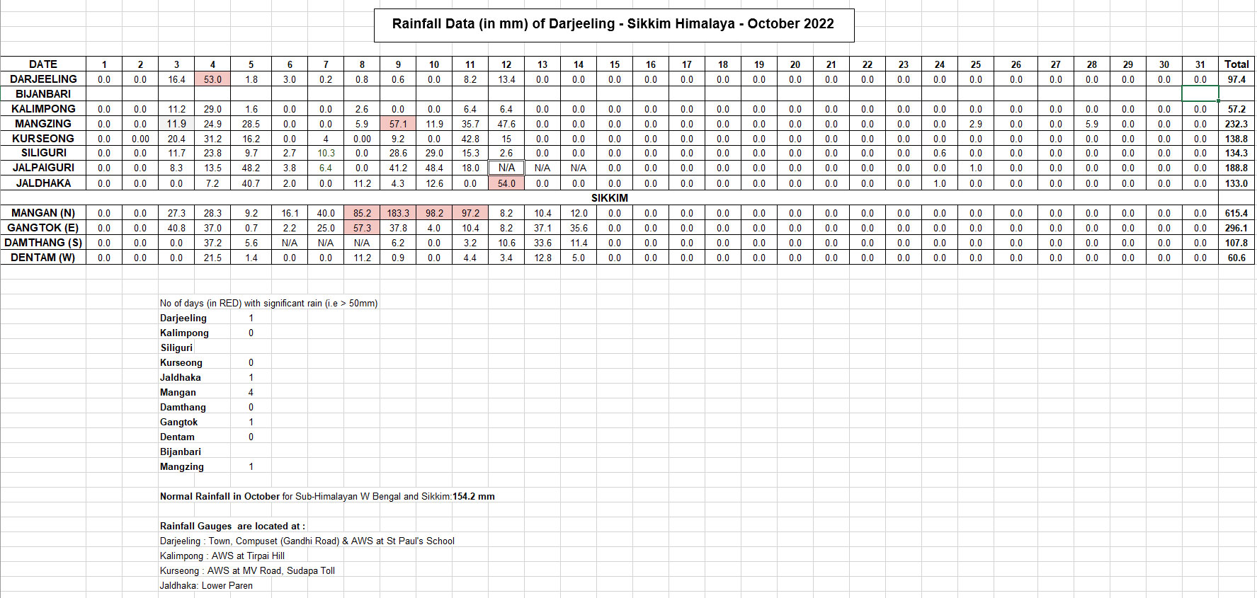
As can be seen from the above table, Kalimpong, Darjeeling, South and West Sikkim had deficient rainfall while East and North Sikkim had excess rain. The plains of north Bengal including Siliguri had more or less normal rainfall.
The rainfall, however was confined to the first half of the month when the monsoons were quite active in the entire country even as the SW monsoons 2022 started withdrawing from the subcontinent. After 15Oct2022 there was no rain.
A series of low pressure areas formed in the Bay, some as remnants of tropical storms from the Pacific.
Remnants of tropical storm 'SONCA' formed a low pressure in the Bay which eventually intensified into Cyclone 'SITRANG' in the Bay of Bengal
SITRANG was the first cyclone to hit Bangladesh after 2017.
Media on Cyclone 'SITRANG' (Indian Express, 25Oct2022):
Power and telephone links have been largely cut and coastal areas plunged into darkness, officials said.
A
tropical storm that lashed Bangladesh left at least 35 people dead and
about 8 million without power across the delta nation, officials and
news reports said on Tuesday.
The
government said about 10,000 homes were damaged and more than 6,000
hectares (15,000 acres) of crops were destroyed. Thousands of fishing
projects were also washed away.
The United News of Bangladesh news agency said about 20,000 people
were marooned because of flooding triggered by tidal surges in the
southern coastal district of Bhola.
Tropical Storm Sitrang brewed
in the Bay of Bengal before turning north toward Bangladesh’s vast
coast, prompting authorities to evacuate hundreds of thousands of people
to cyclone shelters Monday. Heavy rains battered the country throughout
the day, flooding many areas in the coastal regions across southern and
southwestern Bangladesh.
Praful Rao
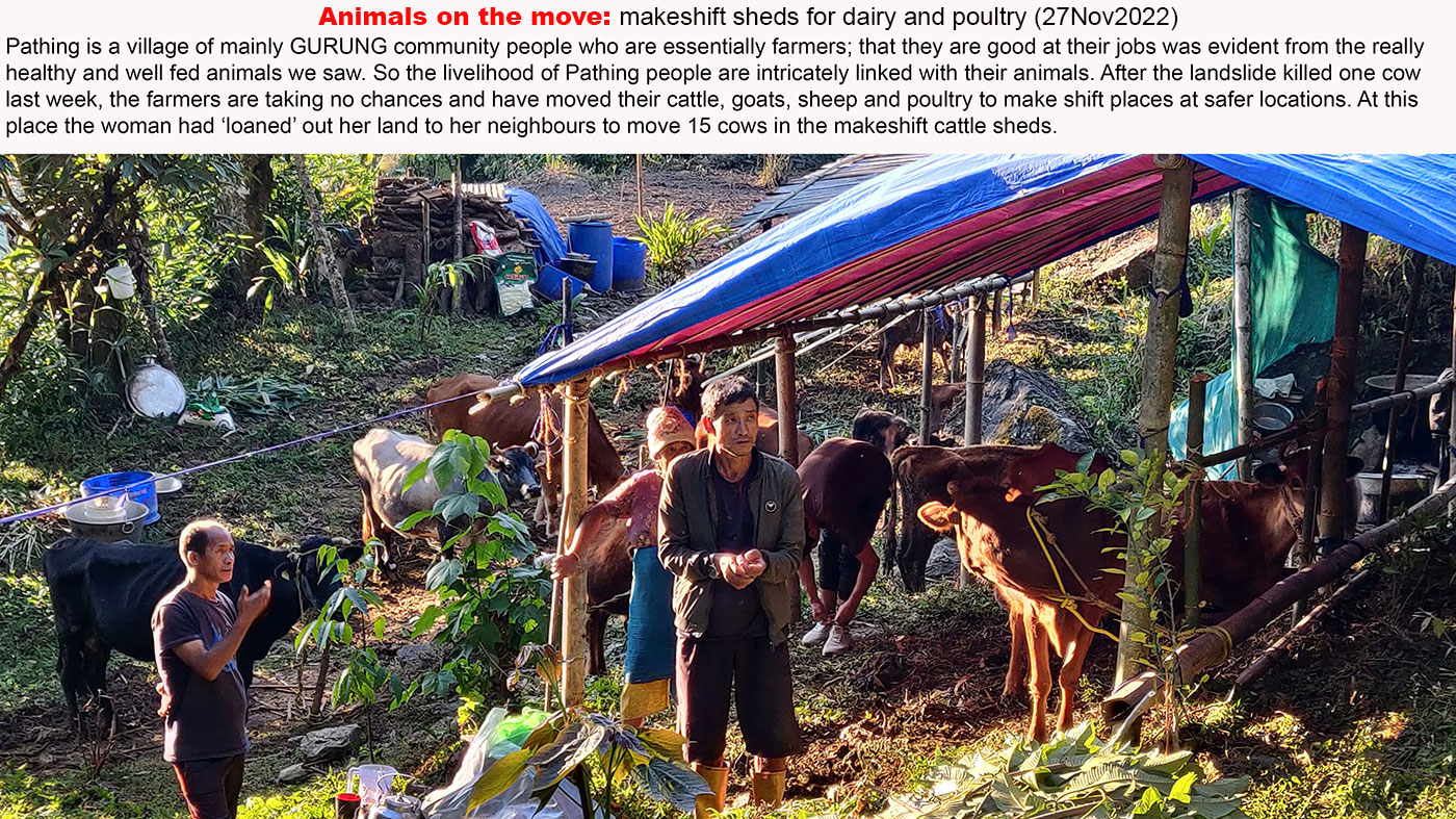
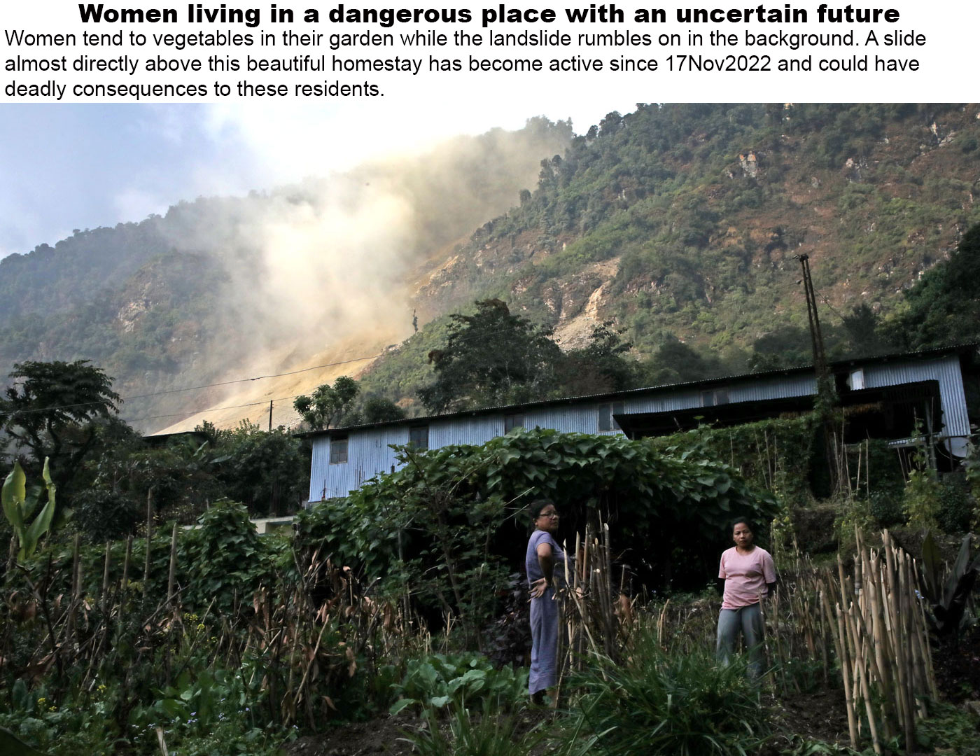
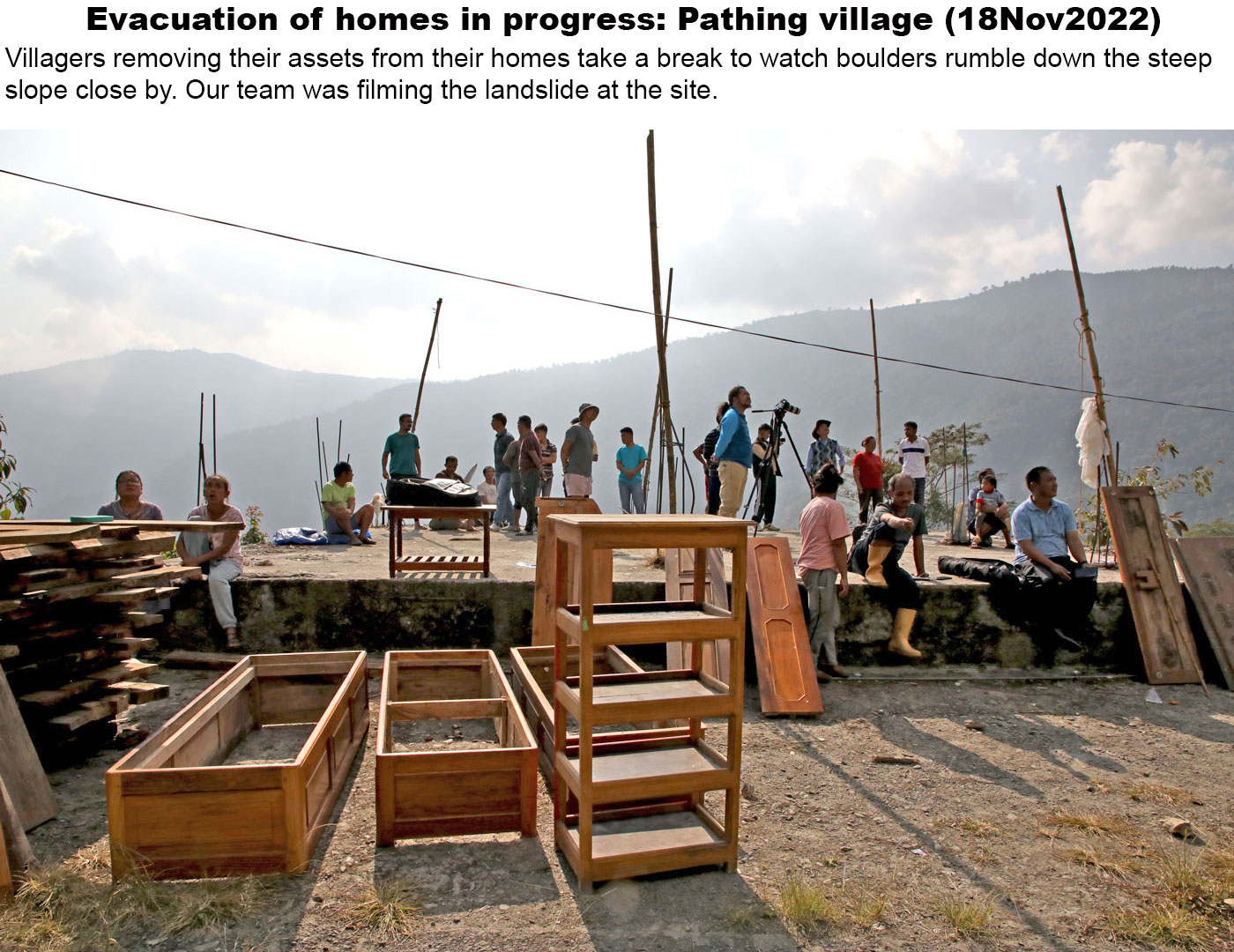
Kalimpong district
Darjeeling Sikkim Himalaya