Monday, September 30, 2013

STH Activities:- At the SMDS III, in Kohima, Nagaland (25-27Sep2013)


STH was a part of a 14 member team from Darjeeling district which attended the Sustainable Mountain Development Summit III at Kohima, Nagaland between 25-27Sep2013. This was the first time that Darjeeling was represented independantly (earlier we attended as a part of the Sikkim delegation) and I am glad to say we did have participants for all the three major themes under discussion during the summit ie WATER, AGRICULTURE and FORESTS.
The summit, organized jointly by CHEA, ECOSS and SDFN was inaugurated by the Chief Minister of Nagaland, Mt Neiphiu Rio on 25Sep2013 and had representation from all the 11 Indian mountain states plus two mountain districts (Darjeeling being one) and had senior executives/officials  from  the Govt of India (MOEF) as well as those from UNDP, ICIMOD, GIS, Swiss govt in attendance.

It gave STH a wonderful opportunity to talk about landslides in a thematic session held on "Hydrological Disasters" and also to interact with many who were interested in the landslide disaster scenario in this part of the world.
STH has been a part of the SMD Summits since its inception in 2011 and wishes to thank the organizers of SMDS III for making our participation possible this time also.

You can read more about SMDS III here (1,2 and 3)

Praful Rao,

Kalimpong,
Darjeeling district


Friday, September 20, 2013

Lucky number 7 : STH's 7th anniversary, this week.

This is our 7th year and considering the fact that the South Westerly monsoon has been mild  in SHWB (Sub Himalayan West Bengal) and Sikkim Himalaya this year, we should consider ourselves lucky. That said, below are some of our accomplishments over the years :

Achievements
  • STH now has three documentary films based on landslide hazards. In 2009 we worked with the mass communications department of St.Josephs's College, Darjeeling and then in 2010 we made two documentaries, one with the Development and Educational Communcations Unit (DECU) of Indian Space Research Organization (ISRO) and another with the Magic Lantern Foundation.                                                                                               
                                   
  • As part of our effort to make communities aware, STH has now participated in and conducted more than 80 awareness programs/seminars and workshops in schools, rural areas and universities.


  • In our Stormwatch series (since 2009) STH has reported the development and tracks of all major weather systems in the Bay of Bengal thanks to the IR imagery and information on several excellent websites using broadband internet; we sent out early warning emails when necessary.                                                                                                                                            
  • We now have an automatic rain gauge in Mangan (North Sikkim) along with the three others in Kalimpong,Darjeeling and Kurseong. Monthly rainfall reports are published for these towns and few others (from www.imdaws.com) for those interested in the hydrology of this area.                                                                                                                                                                                                                                                    
  • Since 2007, most of the major landslides in the vicinity of the SHWB and Sikkim have been documented on our blog 'Visions of Hell' with probable cause and effect, in an effort to highlight the severity of this disaster form in this region. 

                                                                  
  • Members of STH met the honourable MP of Darjeeling Shri Jaswant Singh for the second time in 07Apr2013. In the discussion followed that day STH made certain suggestions and requests regarding the landslide sitiuation in the hills of Darjeeling which can be found here.                                                                                                                                                                                                 
  • In Dec2012 , we had a senior geologist from the GSI (Geological Surveyof India)  Mr.Debashish Bhattacharya in Kalimpong for 10 days. It was our pleasure to have him with us whilst we did a recce of all the landslide sites in the vicinity of the Kalimpong Sub-division. Such visits if more regular will create a greater understanding of landslides and the hazards associated with them.                                                                              
      

  • STH has also done a substantial amount of work in the field of CBDRM (Community Based Disaster Risk Management), in some of the major landslide prone areas in Kalimpong ( Chibbo/ Pashyor, Dumsi pakha , Dhobi Dara).
    Having watched the response to the 18Sep2011 Sikkim earthquake and the recent Uttarakhand disaster, we will have to intensify our work with the communities since they would largely have to cope with future disasters on their own at least for a limited time period.


  • We successfully imported 15,000 saplings of non-aromatic Vetiver grass (very effective at controlling soil erosion ) and distributed it amongst 15 NGOs in the district.The results have been quite positive with 60% survival rate and we hope to go in for a much larger plantation in landslide prone areas in the Kalimpong sub-division in the future.
                                                                                                                                                                                                                                                       
  • We have worked with the NDRF (National Disaster Response Force) in conducting and coordinating training workshops (see here and here). Recently, we also did a workshop for the WB SDRF ( State Disaster Response Force ) in which we covered causes and effects of landslides, followed by field visit to landslide affected areas in Kalimpong.                                                            
           
  • In 2009 STH won the Manthan award ( for best practices in e-Content and Creativity ) which includes all SAARC countries. This year we've taken a step further by being the only NGO from India to be listed among the Six finalists in InterAction's  " FEDEX Award for Innovations In Disaster Preparedness". On 12Sep2013 we took part in a webinar in which all six finalists gave short presentations on their innovation and how it benefits the targeted community, excerpts from that webinar can be found here.                                                                
     
  • Our blog "Visions of Hell" has more than 570 posts, has been viewed more than 101,020 times by a world wide audience and is a mammoth resource and a historical archive on landslide disasters in the Darjeeling- Sikkim Himalaya.
    All data and material on our blog is available free of cost for non-commercial use.
Though the task ahead is daunting, STH is slowly inching towards its principal objective which is the prevention, mitigation and management of landslide hazards in the Darjeeling and Sikkim Himalaya.
By enhancing public / government awareness and building capacity we can increase the resilience of our mountain communities towards landslide disasters and learn to live better with a disaster form which is as old as the mountains. 

Rohan Rao,
Kalimpong,
Dist-Darjeeling,
rohan.rao1313@gmail.com 

Wednesday, September 18, 2013

Excerpts from the Webinar held on 12Sep2013 by Interaction for "FEDEX award for Innovations in Disaster Preparedness"


SaveTheHills is shortlisted as one of the 6 finalists for the FEDEX award for "Innovations in Disaster Preparedness" and as such participated in a webinar organized by Interaction on12Sep2013.
Placed above is a 12 minute clip, a sort of collage of the webinar of 12Sep2013. The entire program lasted a little more than an hour and mercifully the internet here was rock steady for the duration.
Anticipating connectivity problems STH had uploaded a  pre-recorded 3min presentaion onto Youtube much earlier and the same was shown during the webinar (whereas most other finalists presented LIVE)

We regret not being able to upload the entire proceedings due to costs involved.

Praful Rao,
Kalimpong,
Darjeeling district

Tuesday, September 17, 2013

Remembering the 18Sep2011, 6.8R Earthquake in this region.


A strong earthquake of magnitude M: 6.8 shook Sikkim and Darjeeling areas of India and adjoining Nepal at 18.11 hours IST on 18Sept 2011 with its epicentre near the Sikkim-Nepal border, about 68 km northwest of Gangtok.
Placed above are some images of the region after the earthquake. You can read on the quake here (1, 2, 3)

Photo credit for Sikkim images: Tseten Lepcha 


Praful Rao,
Kalimpong,
Darjeeling district

STH ACTIVITIES (16Jul2013): Educating the Trainers - Awareness camp and field visit with members of 10/12 battalion WB SDRF (State Disaster Response Force)


16Sep2013
STH held an awareness camp for 14 members (including two officers) from 10/12 battalion Armed Police who have recently been the assigned the role of the West Bengal SDRF (State Disaster Response Force). As is known during non-disaster periods eg the dry winter months, a primary role of both the national and state disaster response forces is training of communities/ NGOs.
The subjects covered in the presentation were the structure of the DM organization in India,
cause and effect of landslides, their prevention and mitigation and landslides zones in the vicinity of Kalimpong town.
This was followed by a field visit to the landslide prone areas at  Dhobi Dhara and Chibbo - Pashyor .

STH has worked with the NDRF (National Disaster Response Force) in the past in raising awareness about disasters and community capacity building (Seen here and here) and hopes to do the same with the SDRF too. 
Special thanks goes to Anand from Compassion International and the SDRF group that came all the way from Siliguri to attend the session.

Rohan Rao,
Kalimpong,
Dist- Darjeeling,
rohan.rao1313@gmail.com


Thursday, September 12, 2013

Challenges of Devastating Indian Landslides - an article by Dr RK Bhandari


It is all in the books that landslides are among the major hydro-geological hazards that affect large parts of India, especially the Himalayas, the northeastern hill ranges, the Western Ghats, the Nilgiris, the Eastern Ghats and the Vindhyas, in that order. In the Himalayas one could find landslides of 
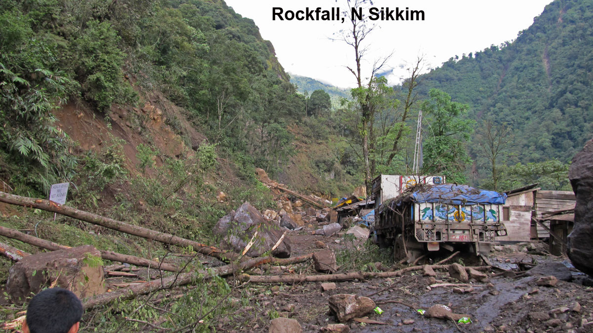
every name, fame and description. India’s northeastern region, the Darjeeling district of West Bengal, Sikkim, Tripura, Meghalaya, Assam, Nagaland and Arunachal Pradesh are all landslide-prone. In Uttarakhand also, it would therefore be inappropriate to see the Kedarnath tragedy of 16–17 June 2013, as merely an isolated event frozen in time and space.
Whenever landslide disasters strike, we rush to lean on fixed ideas in our minds. From the school days we are tutored that events like landslides and earthquakes are only to be regarded as nature’s safety valves because we live on the surface of an unfinished planet. The fragile ecology, immature geology, meandering rivers, snow bodies, climatic variations and cloudbursts of the Himalayas are after all our inheritance without choice. For centuries, landslides have come and gone, and these can be explained by recounting a long list of causative factors. If and when our justification is not good enough, there is climate change to buttress our argumentation. But, by ignoring human violence against nature, we only speak the half truth. Let us always remember that ‘a scientific truth does not triumph by convincing its opponents and making them see the light, but rather because its opponents eventually die and a new generation grows up that is familiar with it’ [Max Planck].
Those who make off-the-cuff conclusions must know that the science of landslides has no contract with their way of thinking. It demands honest and comprehensive scientific studies. We can understand landslides only by elucidation of landslide boundary-shears, concurrent monitoring of time-dependent piezometric pressures, surface and subslope displacements and mapping of ground deformations and shear zones, plus behavioural studies of associated human settlements form an integral part of the landslide investigation. Sadly, success will continue to elude us so long as scientific landslide investigation does not precede landslide remediation. We have not been able to fix the landslides not because of lack of expertise or technology, but because we never had the will or direction to do so.
It has almost become ritualistic to name cloudburst to explain away cataclysmic floods and devastating landslide events, without even attempting to understand the slope dynamics in the ecological theatre of nature. We did so to explain the great Alaknanda tragedy of 20–21 July 1970 in Uttarakhand on the premise that the previous maxima of 200 mm rainfall recorded at Joshimath on 28 September 1924 was crossed by a new high of 212.8 mm. Further probe removed a layer to show that the tragedy was caused by the bursting of a landslide dam. The formation of the landslide dam on Alaknanda was then traced to the enormous sediment load brought by Patalganga. And this huge sediment load was in turn traced to numerous landslides in the Patalganga valley. Further, it became evident that these landslides themselves were the result of neglect, misuse and abuse of our lands for decades on end. But for the ecological neglect, the Alaknanda floods would not have hit the headlines.
We are yet again stumped by the ghastly Kedarnath tragedy and cajoled by the very same reason – cloudburst, which is in fact no more than the most visible trigger at the tipping point. Could we have anticipated the trouble? The answer is no, because we had neither fail-safe instrumentation nor real-time vigil on our glaciers, glacial lakes, moraine  accumulations, dormant and active landslides, rivers and their tributaries and unsafe housing stock. We plead for zero tolerance against mindless urbanization, but suffer it instead. We have mapped landslide hazards on the pilgrim routes many times over, but never placed a single user-friendly validated map in the hands of disaster managers. We should do it now.
We should not continue to ignore the gross disconnect between our scientific discourse and our approach to hazard-mapping. In scientific discourse, we dread factors such as climate change, exceptional rain, receding of glaciers, bursting of glacial lakes, poor road alignments, non-engineered constructions, earthquake-induced landslides, and overtopping of dams. However, in the case of hazard-mapping, we disregard all these factors and only account for lithology, structure, slope morphometry, relative relief, land use/land cover and hydro-geological condition India needs large-scale, validated and user-friendly hazard maps based on a scientific understanding of the multitude of factors, both natural and human induced.
The main reason why the natural landslide hazards are turning into man-made disasters is because people have not only moved in large numbers to the remotest of the mountain slopes where no one ever lived before, but the violence they have unleashed against nature is unprecedented. There is a Chinese saying that ‘a man who removes a mountain begins by carrying away small stones’. We have been removing, not small stones, but mountains of rocks for building townships, roads, dams and reservoirs. Many of the landslides we know are the result of these very actions, and they in turn remove from slopes incredibly large amount of sediments, loading rivers, silting reservoirs and creating new land masses in the sea. Little do we realize that when a slope gets robbed of one inch of its soil cover, Nature may take nearly 1000 years to replenish it! It is time therefore to revive the Chipko Movement and reverse the trend of slope degradation.
One vexing question which often haunts us is whether a landslide can be predicted and a landslide disaster averted? In Uttarakhand, some of the landslides occur annually. We do not need any rocket science to predict them; simple slope instrumentation and monitoring would do. Similarly, mountain slopes supporting human habitat with visible signs of instability like tilting of trees, bulging of retaining walls and widespread ground subsidence are already on the verge of failure. What more early warning do we need to predict a landslide in such situations? It is a scientifically proven fact that even the first time landslides are predictable provided we probe deep enough to arrive at the bottom of the truth, through studies, instrumentation and monitoring. Like human beings, a slope also has a heart that beats! Let us recall Terzaghi, who more than six decades ago said that ‘If a landslide comes as a surprise to eye witnesses, it would be more accurate to say that the observers failed to detect the phenomena which preceded the slide.’
Today, we have the knowledge, tools and experience we need to predict and avert most, if not all, landslides. By tapping the phenomenal power of geotechnology, instrumentation, remote sensing, integrated GPS and information communication systems, we can monitor unstable areas in real time even during unfavourable weather conditions. It is time therefore to launch selected mission-mode projects to initially cover timely prediction of (a) possible reactivation of major old, dormant and seasonal landslides, (b) landslides and floods due to bursting of glacial lakes, (c) flash floods due to bursting of landslide dams, (d) first-time landslides in urban and strategically important areas falling in the zone of exceptional landslide hazard and (e) rockfalls. But, why is this not happening?
The criteria for early warning against landslides we use must be credible. The direct connection between ‘incidence’ of a landslide and ‘rainfall’ may look both obvious and simple, and may even work in cases where ground conditions are already bad enough and rainfall exceptional. There is a strong case to position monitoring stations to advance on-line rainfall forecasting procedures using digital radar data and an on-line run-off forecasting procedure based on space techniques to enhance lead time. The early warning criteria we aim should be rooted in holistic and concurrent interpretation of real-time rainfall records, seismic records, spatial piezometric variations, slope surface and subsurface movements and movement rates on discrete boundary shears, runout effects and other collateral threats in the catchment and on the higher slopes. We should refrain from over-simplifying the criteria for early warning to minimize bogus forecasts and it must be continuously put to test. We must prepare ourselves to effectively utilize every second of the available lead time.
We have all agreed time and again that landslide disaster management should be integrated with development planning. The vast potential for hydro-power in Uttarakhand is in a sense a big blessing, but the way it is being exploited is a curse as hydro-power schemes are no longer environment-friendly and power generation is no longer based on natural flows and sound engineering. Unless safety issues appear continuously on RADAR, mega projects like the Tehri dam will always keep us on tenterhooks.
Dozens of landslides in India, like the one at Kaliasaur on the Srinagar–Rudraprayag highway, are quite old. We should fix them once for all. A township on a landslide infested mountain slope can be best tackled by looking at the stability of the mountain as a whole rather than frittering away the resources in fixing landslides affecting individual buildings. We need breed the culture of truth-seeking rather than data-seeking nature of landslide investigations. Our reports and papers by hindsight reflect more of perceptions inspired by loyalty to the accepted trends than science. In many cases, truth eludes us because vital field evidences get erased even before landslide investigations begin.


R. K. Bhandari

Forum on Engineering Interventions in Disaster

Mitigation,

Indian National Academy of Engineering,

New Delhi 110 016, India

e-mail: rajmee@yahoo.com

Comment by Praful Rao
Dr RK Bhandari, is long acknowledged to be one of the foremost authorities on landslides in the world. STH is proud to be associated with him from several years back.

Sunday, September 8, 2013

Monday, September 2, 2013

Rainfall data Darjeeling district and Sikkim: August 2013


August 2013 saw a flurry of activity in the Bay of Bengal with a number of low pressures forming. The low pressure reported just south of Kolkata by IMetD on 19Aug2013 caused moisture bearing clouds to move towards the Darjeeling Sikkim Himalaya resulting in the "Hurricane" in Darjeeling between 22:00 hrs and 00:00 hrs that night.

Strangely, even though the bay was swamped by low pressure systems in August 2013 , the Darjeeling Sikkim Himalaya and most of the North East still remained deficient in rain. Most of the low pressures that formed traced a North Westerly path giving excessive rain to most of central India and Rajasthan (shown above). 

No fatalities were caused by landslides in August 2013

September is when the SW monsoon slowly retreats from the Indian sub-continent, nonetheless from this month onwards STH will also include rainfall data from Siliguri and a few other stations in our monthly rainfall report for those interested in the hydrology of this area.   

Rohan Rao,
Kalimpong,
Dist-Darjeeling,
Email-rohan.rao1313@gmail.com