Showing posts with label preparedness. Show all posts

Wednesday, February 14, 2024

Impact of the Teesta Valley Glacial Lake Outburst Flood (GLOF) - updates from North Sikkim (Feb2024)

As has been reported by us in this blog, the GLOF disaster of Oct2023 devastated large parts of the Teesta valley both in Sikkim and W Bengal. Placed below are some recent updates from North Sikkim:
Naga area of Mangan district
The devastation in Naga and Toong area of Mangan district has been covered here.
Recent (09Feb2024) closeup photos of landslide affected areas of Naga are shown below:

A telephoto image of the same area which I took from the opposite hill on 18Nov2023 (below) reveals hardly any change in the intervening 3 months.

As per my source in Chungthang, people from these homes have evacuated and are living with relatives or at rented places.
Toong bridge and road status
The GLOF of 04Oct2023 destroyed the bridge over the Teesta river at Toong (see photo of 18Nov2023 below). This bridge connected Mangan (dist HQ of North Sikkim) with Chungthang

A 'log' bridge (below) built in this area has temporarily restored this communication route.
However, for the time being the bridge is closed between 10.00am to 4pm to allow road repairs as such commercial vehicles and others still have to route via a long route via Saffo- Shipgyer - this route not only takes double the time but is narrow and dangerous at places.
As per information received, the progress of repair of Chungthang - Mangan road and also the Chungthang - Lachen road is slow and this is worrisome since the pre-monsoon season accompanied by intense thundershowers are due to start in March 2024.
Here are some rough stats:
a. The freight charges for a truck with 10 tonnes of load from Siliguri to Chungthang was approximately Rs22,000/- (incl of taxes), when the main roads were available.
b. Now, since the main roads are not available, the detours have pushed up the freight charges to Rs 31,000/- and also the trucks can only carry 8-9 tonnes of material on the alternate route.
c. So because the freight charges have increased while the load which is being carried has decreased - a single brick in Chungthang now costs Rs18.
Chungthang town
Among all the urban centers impacted, the GLOF dealt it's severest blow to Chungthang town at around 12.35am on 04Oct2023. We have covered it in detail here
Even when we visited the town on 18Nov2023, more than a month after the devastation, the whole place still looked like a war zone but I am glad to know that the people of Chungthang are slowly getting back on their feet again. Placed below are recent images of Chungthang town where the almost 10 feet of sludge mud and sand which buried the streets, homes and buildings have been cleared off and shops are open and life is slowly getting back to normal.

Praful Rao
Kalimpong district
Darjeeling- Sikkim Himalaya
savethehills@gmail.com
9475033744

Wednesday, November 22, 2023

Report and recommendations on the GLOF disaster which affected Teesta valley in Oct2023.

We, in the Darjeeling Himalaya Initiative (DHI) submitted a report (with recommendations)  to the NDMA and the SDMA’s of W Bengal and Sikkim based on our observations and interactions with affected people in the numerous visits to GLOF affected areas between 27th mile, Kalimpong District, W Bengal and Dikchu in Gangtok district, Sikkim more than a week ago. The reports were substantiated by the many posts and photographic records on the disaster made in the SaveTheHills blog.

Having visited some of the worst affected areas in North Sikkim between 17-19Nov2023, we can only reaffirm what has been reported:

  • We need an expert team to visit these areas and advise us the course of action to be taken in the limited time we have before the next monsoons.
  • That we should focus on building the resilience of communities in the flood affected areas while continuing with the recovery and reconstruction process, since many of our populated areas in the Teesta Valley in Sikkim and W Bengal will again be affected during the Monsoons 2024.
  • That time is of essence.
The full report is reproduced below:

Report and recommendations on Glacial Lake Outburst Flood (GLOF) affected areas between Dikchu (Sikkim) and Teesta Low Dam Project III (TLDP III, 27th mile), Kalimpong (West Bengal)

Report Drafted by SaveTheHills

Submitted by SaveTheHills and Darjeeling Himalaya Initiative
Reported areas are in RED circles

  • What we people living along the Teesta valley in parts of Sikkim and Kalimpong District of West Bengal, witnessed in the early hours of 04Oct2023 was a rare, dangerous and a huge catastrophe with the Glacial Lake Outburst Flood (GLOF) from South Lhonak Glacier, massive dam breach at Chungthang and subsequent floods causing loss of life and livelihoods and devastating large areas of the valley. The size and scale of the event has far escaped the appropriate attention of both the national and concerned state governments. It has been totally under reported by the mainstream media. Many of us, even from Darjeeling and Sikkim Himalaya have pushed it to distant memories and forgotten that there is massive work ahead with rehabilitation and mitigation.

  • When the very turbulent waters of the GLOF from South Lhonak glacier located at 17,300 feet above mean sea level crashed into the already brimming reservoir of the 1200MW Sikkim Urja Dam at Chungthang, the dam was quickly overwhelmed and burst, releasing a wall of water which was 10-15 feet high. This deluge swept through the Teesta valley, destroying everything in its 162 km rampage from the glacier to NHPC Teesta Low Dam Project (TLDP) III at 27th Mile in Kalimpong district.
  • This report is an attempt to preserve facts of this humongous event and to urge both government and civil society to recognize and respect the vulnerable fragility of the Himalaya. It is extremely apparent that there is the need to be prepared for more such disasters as the Himalaya gets warmer.
  • The fundamental recommendations stem from extensive field visits to GLOF affected regions and in-depth conversations with the affected residents. Having witnessed the profound impact of this catastrophic event on infrastructure and communities, it is crucial to recognize that we have a mere five-month window to initiate remedial actions. Our primary objective is to empower and ready the traumatized community to confront the challenges of the upcoming monsoon season in 2024, ensuring improved safety and resilience, and safer road networks for the thousands who transit each day.
  • We have not visited Chungthang and other affected areas in North Sikkim as yet, but have made several visits to GLOF affected areas between Dikchu and 27th Mile (Kalimpong district) and photo essays from our visits are placed in the STH blog http://savethehills.blogspot.com.
  • It is requested that this report be read in conjunction with more specific inputs from our photo essays in the STH blog which will amplify the observations that are made below.

    Teesta river in spate at the Teesta bridge, on 04Oct2023 (drone image)

Observations

The Teesta river 

  • The Teesta is still unusually large and fast for this time of year. As such it is continuously eroding sections of NH10 as well as low lying populated areas like the Teesta bazar.
  • The river level, post GLOF is much higher; undoubtedly due to the silt deposits as the river slows down in areas of less gradient. In this regard, Mr Lalitendu Tripathi, Executive Director, NHPC, (North Bengal and Sikkim) stated in an interview with a local TV channel ‘Himal World’ that the level of the whole Teesta Basin had increased by 3-4m due to the debris deposits.
  • Locals blame the huge silt deposits by the Teesta on the IRCON project and the tunnel excavations which were dumped on the river banks and which were swept away by the GLOF. To make matters worse, the sludge and sand that is being excavated from all areas as communities try to rehabilitate is being dumped back into the river or onto the river bank. This will undoubtedly increase the silting of the river and increase the river levels even further.
  • Many of the affected people interviewed stated the river was ‘far away and far lower’ before the GLOF event. As such, Teesta at many places is now flowing in the vicinity of populated areas, some of which are subsiding.
  • The amount of debris which has been brought down by the GLOF is phenomenal and besides tree trunks and branches which are visible and strewn all over the river banks, the invisible heavier debris would also include metal from the many bridges swept away, vehicles, boulders and parts of homes which must be buried deeper in the sand and also ammunition and explosives which make the task of clearing the debris risky.
  • The thickness of the silt/sludge deposits on the river bank, roads or burying homes is 10 feet or more.

Early warning mechanism

  • The media is fuzzy whether an AWS (Automatic Weather System) or a GLOF EWS (Early Warning System) was available in North Sikkim but whatever was installed, failed to work.

    What worked was a much more primitive system where alerts were sounded on bull horns, doors were banged, whistles blown and people informed on cell phones that ‘the river had become big’ and they should move to higher ground. At places the police force was very effective but in the end it was just people reaching out to each other, to their friends and relatives downstream which resulted in less casualties.
    All this took place when our entire region was being pelted by heavy rain, in pitch dark in the early morning hours on 04Oct2023. It was fortunate that the cell phone system worked otherwise there would have been far more fatalities.

Impact on communities and settlements


  • We talked to numerous GLOF affected people in Sikkim, as well as in Kalimpong district. Everyone unanimously said they were scared of living in their present homes and requested the government or political party to relocate them to a ‘safer place’.

  • Many homes in the shanty /slum areas were swept away by the GLOF (IBM colony – Rangpo, below the Melli bridge, at Teesta Bazar, Geil Khola and Bangay bazar.) Displaced residents from here are living in relief camps or with relatives in Kalimpong district (W. Bengal). Affected people from Sikkim were given compensation by the government on 26Oct2023and have returned home – relief camps in Sikkim have been closed.
  • Many of the RCC homes survived the floods but were buried under a 10-15 feet blanket of sand and sludge. The owners of these homes are excavating their homes and returning.
  • Some parts of Teesta bazar which are on the river bank are subsiding due to the erosion of the river which is now flowing very close to these areas.
  • Many buildings and homes adjoining the river banks have now been weakened with large cracks and their foundations eroded.
  • Many concrete homes (which were not washed away) are still submerged in water at places.

Impact on the roads, NH10 (Singtam to TLDP III section) and bridges

  • Parts of the Teesta to Darjeeling road was under water until 20Oct2023. This road and
    NH10 were opened for light vehicle traffic only and between 6am-6pm, on 21Oct2023.
  • Due to the restriction in heavy vehicles using NH10, all the heavy vehicle traffic from Sikkim and Kalimpong is now being routed thru the Lava - Gorubathan route. This is causing severe traffic jams in certain areas as well as disturbance to residents of Kalimpong, Pedong and Lava since the traffic is only allowed to operate at night. This route from Kalimpong to Siliguri is also much longer and takes 7 hours whereas the NH10 route only takes 3 hours Consequently, this detour directly affects the availability and cost of goods in Kalimpong and Sikkim.
  • With the river level much higher now, it flows almost at the same level as the Teesta – Darjeeling road.
  • When checked on 02Nov2023, parts of Teesta bazar – Tribeni road were still submerged under the Teesta river.
  • NH10 has been damaged severely at many low lying areas where the Teesta flows close to the road. In such areas, the edges of the road are cracked and the river continues to pull down chunks of the road making driving on this road a risky proposal (hence the timings for use of the road and restrictions on heavy vehicles). Examples of such areas on NH10 are

     - Directly opposite Melli bazar
- From Teesta bazar to Baluakhani (TLDP III) towards Siliguri.

  • While the 29th Mile landslide near Teesta bazar remained stable during the GLOF, a very old landslide which had been dormant for decades was activated at Likhu Bhir.
  • Many sections of NH10 are subsiding into the river.

  • Major bridges (in the area surveyed) which were destroyed by the GLOF were Indreni bridge linking Singtam with Adarsh gaon and NHPC bridge from Tar Khola to the Patel Engineering Complex in Sikkim.

 Condition of the dams and economic impact.

  • Sikkim – Urja dam Stage III has been destroyed.
  • The NHPC dam at Dikchu (Stage V) has also been severely damaged by the GLOF and as per the Executive Director (NHPC), Mr Lalitendu Tripathi it would take a year to restore operations.
  • NHPC Stage VI dam at Sirwani (Sikkim) had a huge amount of debris dumped into it and the under construction power station for this dam at Tar Khola (with Patel Eng.) was almost wiped out.
  • We do not know the condition of TLDP III fully. However, the 3-4m siltation deposit on the riverbed and repair of some damaged mechanical parts will prove a challenge here. Moreover, filling the reservoir will probably flood parts of Teesta bazar, the Teesta - Darjeeling road and the Teesta -Tribeni road.
  • As on date no major dam has been functioning in the Teesta valley from 04Oct2023, upto and including TLDP III.
  • The economic impact though not exactly known is huge and much of it is being claimed from insurance. The complete socio-ecological loss of the disaster is incomprehensible and not easily monetized.

Impact on areas not surveyed

  • Our surveys thus far have been confined to urban areas and accessible roads, limiting our assessment of the situation. The catastrophic impact of the GLOF plus dam burst is starkly evident in the extensive damage inflicted on forests, as millions of uprooted trees now litter the riverbanks.
  • The vulnerability of these remote, less-accessible areas needs to be assessed as we anticipate the upcoming monsoon season

Recommendations

1. Detailed Assessment of the GLOF impact and its future repercussion

An expert committee needs to be set up urgently to look into:

  • High river levels, likely flow pattern of the river and vulnerability of populated areas in the proximity of the river in the next monsoons.
  • Assessment of condition of NH10 and other roads in areas impacted by GLOF. As on date, many places between Likhu Bhir and 27th Mile and around Melli show signs of subsidence.
  • Alternate routes for heavy and light vehicles, timings for use of roads and traffic control in such areas need to be planned and informed to the public.
  • Vulnerability of sinking populated areas such as those in Teesta bazar and other places needs to be studied and mitigation methods such as protective embankments implemented.

2. Rehabilitation of affected homeless people

  • Rehabilitation is an extremely traumatic and distressing experience for people affected by disaster where they have to uproot themselves from their homes and relocate to a strange, different place and adapt to an entirely different environment.
  • The GLOF event has resulted in many people whose homes have been swept away and their place of residence has become too dangerous to live in and as such today temporarily live in relief camps or with relatives or in rented places. The number of such people will increase in the future as more areas get affected by the Teesta river.
  • Relocation of such people needs to be planned and looked into and safety, opportunities and well being factored into the rehabilitation process.

3. Strengthen preparedness

  • A fail safe Early Warning and Dissemination System needs to be provided in the vulnerable areas of Teesta Valley.This should be a system which will continue to function in a disaster scenario with severe power outages and damage to cell phone towers - which is likely to happen in a major disaster.
  • Manual hooters and other disaster alerting systems should have a distinct sound which cannot be confused with ambulance or other siren sounds.
  • The status of NH10 and other prominent roads must be informed to the public through social media or electronic sign boards at key places.
  • Relief centres in vulnerable areas should be planned in advance so that they could be set up rapidly in the event of a disaster. Solar lighting/ generators must be provided in such places.
  • The cell phone system in the Teesta valley played a crucial role in saving numerous lives and ensuring continuous communication with affected individuals during the recent disaster. However, given the susceptibility of this communication system to landslides and power outages, it is imperative to establish a resilient backup solution. Implementing ham radios as a back-up communication may be considered. These ham radios can be operated by ex-servicemen, who are already trained to operate such equipment.
  • Investment in power rescue tools, solar lighting, first aid training, home insurance, AWS (automatic weather stations), etc. all would be immensely helpful in building a more resilient community.

4. Capacity building and raising awareness.

  • Massive awareness campaign along with CBDRM needs to be implemented. Many lives were lost when people chose to ignore the warning issued either on the cell phone or in person.
  • Periodic evacuation drills need to be conducted in all vulnerable areas.
  • Capacity building for communities in the valley has to be a priority action. Their experiences of what worked during the disaster therefore needs to be strengthened. What were the gaps needs to be studied, improved and documented. Serious efforts must be made for working on the gaps in a time bound manner, with constant monitoring mechanisms put in place.
  • A ‘Lest we forget’ memorial can be made by preserving any of the structures that have been impacted by the floods. This can be developed into a good awareness and educational space for people to visit with interpretation material that consist of write ups / photographs / human stories on the event of October 4th 2023.

Conclusion

As has been stated already, the Oct2023 disaster is the most serious disaster to have affected the Darjeeling -Sikkim Himalaya after the October 1968 deluge. It has not received due attention because its greatest impact was confined to the Teesta valley that does not always take center stage. Also the number of fatalities was comparatively limited and disaster discourse does not fully acknowledge the socio-ecological importance of the mountains and the cumulative loss due to disasters. The impacts of the GLOF, dam breach and subsequent impacts on infrastructure and urban settlements cannot be understated and needs to be looked into with urgency and importance. Time is of essence, with the monsoons of 2024 just months away. We urge experts to visit and assess the situation and remedial action to be initiated without delay so that the impacts of this disaster do not continue into the coming monsoon.

Saturday, February 26, 2022

SaveTheHills activity: Workshop in a remote village school on 'How to be better prepared for disasters in 2022' (25Feb2022)

Manzing (Pokhriabong GP, Gorubathan Block of Kalimpong district) is a remote village located almost 20kms south east of Kalimpong.
On 25Feb2022 while attending a workshop organized by Anugyalaya DSSS there, it took us 3 hours to reach the High School where the program was organized. I traveled with a group of Fire Brigade personnel who had a demo and talk on Fire Fighting.


My thanks to Mr Sudip Bomzon of Anugyalaya for organizing the workshop and I have added
Mr Praveen Ghising, Head Master of the Pokhriabong High School (Gorubathan) to 'Hazard Alerts' our Whats App group so that he can pass on our warnings and weather information to the children and staff.

Praful Rao
SaveTheHills,
Kalimpong District
Darjeeling Sikkim Himalaya

Sunday, August 21, 2016

STH Stormwatch : The Movement of a Storm in 24hrs (20-21Aug2016)

As I write, this storm is very active over south Bengal where there is continuous but moderate rain, in Kalimpong we have thundershowers.
Update on the above storm  (22Aug2016)
The thunderstorm continued well into the night; rainfall data is given below. One person died in a fatal landslide at Samrik Paani, Pokhriabong, Darjeeling last night and NH10 which is an arterial highway linking Siliguri with Gangtok was blocked at Likhu Bhir (see below) and 10 other places.

Rainfall data of 21Aug2016 (in mm)
21Aug2016 started off as a hot sunny day. It clouded up in the afternoon and in Kalimpong it rained from approx 1530h till about 2130h.
Kalimpong : 45
Kurseong : 95.8
Siliguri : 18
Mal Bazar : 95
Gangtok : 14.8
Darjeeling : 74.6

Praful Rao,
Kalimpong,
Dist Darjeeling

Monday, April 27, 2015

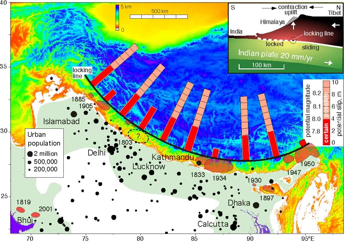
A warning gone unheeded : 'Nepal capital Kathmandu high risk area for catastrophic earthquake (2013)'

Placed below is an article published in Jan2013.
Kathmandu is one of the most vulnerable cities in the world, also experienced rapid urban development ..
The population has increased from 427,045 in 1991 to 671,805 in 2001 and is projected to touch a figure of 915,071 in 2011 and 975,453 in 2012 ..
Construction of buildings considered too weak to withstand a powerful quake, similar to Haiti catastrophic earthquake of M 7.0 what kill more of 316,000 people ..


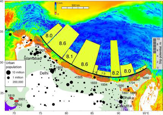
Images of the Main Himalayan Thrust (MHT) fault showed that a segment of it dips downwards by 15 degrees, and is steeper and further north than suggested by previous observations. This dip could rupture and cause an earthquake of magnitude 8 or more, often referred to as a mega earthquake.
The researchers predict that the segment will break over a larger area of the fault and create a larger magnitude earthquake than previously thought.
"The larger the area of the fault that breaks, the more energy is released, and the larger the magnitude of the earthquake,"
The study, presented at the American Geophysical Union Fall Meeting in San Francisco earlier this month (7 December), measured ground movements. By placing seismometers closer together in one area, the researchers have been able to produce a more detailed image of the MHT. Klemperer says a big earthquake would start at the top of the sloping segment. "This is in central Nepal — where Kathmandu is — but such a big earthquake would devastate a much larger area." "This would cause huge landslides, some of which would dam rivers, and produce large lakes. There would be catastrophic floods," he says.
"The main area of concern is in central and west Nepal, where there has not been a large earthquake for a long period," Petley told AFP after Sunday's 6.9-magnitude quake damaged hundreds of homes in the east of the country. "This is an earthquake-prone area, so this suggests that there is a large amount of energy stored," he said.
Nepal is a highly seismic region, lying above the collision of the Indian and Eurasian plates that created the Himalayas, and major earthquakes have hit the Kathmandu Valley every 75 years on average over recent centuries.
One quake destroyed a quarter of homes in Kathmandu 77 years ago, and geologists believe the area is at immediate risk of an 8.0-magnitude tremor - ten times the size of last year's Haiti quake which killed more than 225,000 people.
"The building stock is not seismically strengthened, suggesting that in a big earthquake there will be large numbers of building collapses," said Petley, of the Institute of Hazard, Risk and Resilience at Britain's Durham University.
GeoHazards International, a US-based research group, has measured the likely death toll from a quake of 6.0 magnitude or higher hitting cities in Asia and the Americas.
Kathmandu topped the list of 21 cities with 69,000 potential deaths, ahead of Istanbul and New Delhi.
_________________________________________
Above article has been referred by
Prof Malay Mukul,
IIT, (Dept of Earth Sciences),
Mumbai

Praful Rao,
Kalimpong,
Dist Darjeeling

Wednesday, October 8, 2014

STH Stormwatch (08Oct2014) : Cyclone 'Hud Hud' forms in the Bay of Bengal


The depression in the Bay of Bengal has been upgraded to a cyclone named 'Hud Hud' or TC03B (JTWC).
'Hud Hud' would intensify in a very severe cyclonic storm and proceed along the track forecast .

Praful Rao,
Kalimpong,
Dist Darjeeling

Sunday, September 8, 2013

Tuesday, May 14, 2013

Updates on Cyclone Mahasen (13May2013)

1. Placed from top to bottom are graphic updates from
a) NASA's TRMM 

b) IMetD
c) US Navy's JTWC

2. Further an excerpt from TRMM  is placed below :-

"Monday May 13, 2013
Tropical Cyclone Mahasen Rain Moving Into Bay Of Bengal
Tropical cyclone Mahasen is moving through the Bay of Bengal and is predicted by the Joint Typhoon Warning Center to impact southeastern Bangladesh and northwestern Myanmar (Burma) in about 4 days."

Praful Rao,
Kalimpong

Friday, March 22, 2013

Reporting an extreme event (21March2013) : More rain in 90mins than the monthly rainfall of March.

Mar - May is technically the pre-monsoon season in India where we do expect thunderstorms associated with Cb activity and in Darjeeling-Sikkim we have been having sporadic rainfall along with thunder and lightning this month.
On 21Mar2013, however, the fast moving western disturbance seen in the IR image above, dumped 37mm of rain and lots of hail in approx 90 mins in Kalimpong.
Considering that the average monthly rainfall (taking data of 5yrs from here) for Darjeeling district for the month of March is 26mm, it seems incredible that yesterday between 3.00-4.30pm  we had more rain than the monthly average rainfall!
My deepest concern and fear in all this is whether we are prepared to face such extreme events which unfortunately becoming more and more frequent.

Praful Rao
Kalimpong

Friday, January 18, 2013

Bhamey Gaon (Sindebung, Kalimpong) - a village where homes disappear


1. The landslides at Bhamey Gaon (N 27°04.136’, E 088°29.626’, elevation 919m) at Sindebung, in Kalimpong have been featured many times on this blog earlier mainly because
a) This landslide if ignored for much longer would impact the stability of Kalimpong town itself (see top image)
b) Something can still be done here to arrest the decay and devastation and the landslide situation is not hopelessly out of control, like in many other areas of the Darjeeling district (eg Balasun, Chibo/Pashyor, and Samalbung).
c) The rural community of this area have suffered in silence for decades despite the many visits by politicians, engineers, geologists, media, scientists and the much touted "paradigm shift" towards disaster prevention and preparedness which has yet to see the light of day in this village.
2. The following persons have lost their land, property, homes and moved elsewhere with their families :-
i)     Shri DS Bhujel
ii)    Shri KB Sundas
iii)   Shri BB Bhujel
iv)   Shri TB Thapa
v)    Shri TB Bhujel
vi)   Shri Gopal Chhetri
vii)  Shri Shiv Kr Bhujel
viii) Shri HB Bhujel
ix)   Shri Ganga Ram Sundas
3. The following persons will lose their land and homes in the foreseeable future
i)    Shri BirBahadur Biswakarma - by Sep2013.
ii)   Shri Shyam Bhujel - within 5yrs.
iii)  Shri Dirga Bahadur Bhujel - within 5yrs.
iv)  Shri RB Bhujel - within 5yrs.
v)   Shri  RB Biswakarma - within 5yrs.
vi)  Shri Sanjay Bhujel
vii) Shri Dilip Bhujel
viii) Shrimati Remina Pradhan
3. This highlights perhaps the most striking difference between landslides and most other forms of disaster
- that after floods and even earthquakes, the victims or survivors can still return to their land and start the painful progress of rebuilding......
- in the case of landslides, the victim or survivor has nothing left to return to because the land itself and everything on it is gone.
Praful Rao


Wednesday, January 2, 2013

In the year's beginning - a sombre warning


  • Delhi has never been so bone-chillingly cold as it is today. At 9.8 degrees Celsius, the maximum temperature in the (Indian) Capital is the lowest in 44 years.
    - NDTV (02Jan2013).
  • Researchers have found that India’s monsoonal rainfall, upon which much of the nation’s agriculture depends, is becoming less frequent and more intense.
    Scientists with the agriculture division of the India Meteorological Department in Pune found that global climate change can cause departures from the historic monsoonal norm, which, on balance would lead to lower yields of rice, maize, cotton, soybeans, and other kharif (monsoonal) crops. During the rabi (dry) season, higher temperatures could cut yields of wheat, potatoes, and vegetables.
    - National Geographic (06Mar2012)
  • Kalimpong (Dist Darjeeling, India), in Sep2012, received 84% of the monthly rainfall in just one week (10-17Sep2012) with the remaining 3 weeks being largely dry.
    - STH blog.
  • In the Darjeeling - Sikkim Himalaya, we have not had any significant  precipitation (rain/snow) during the winter months for the last 3-4 years and what we are seeing are drought-like conditions for 7months of the year (Oct-Apr) followed by 5 months (May-Sep) of erratic rainfall. As such, looming ahead is a severe water crisis in this region.
    - Observation made locally.
  • Also rainfall patterns have changed in the Darjeeling - Sikkim Himalaya , with the continuous, gentle drizzle which so characterized the monsoons in the hills, being replaced by sharper and more intense downpours.(This sort of gels with the findings of researchers in the National Geographic report above).
    Sharp, intense rainfall generates higher volumes of surface runoffs and consequently more erosion and landslides.
    Increased surface runoff also means the underwater aquifers do not get time to be recharged and mountain springs are drying up like never before all along the Himalaya.
    - Observation made locally.
  • Weather extremes are not that extreme any more. Heatwaves, floods, droughts and wildfires are the new reality of an ever warming world
     -The Guardian (19Sep2012)
  • The first nine months of 2012 were the hottest in the United States on record.
    - Washington Post (30Oct2012)
  • 3 of the ten biggest floods in Lower Manhattan since1900 occurred in the last three years… Freak weather seems to be here to stay all over the globe.
    - Fareed Zakaria GPS (CNN, Nov2012,).
  • The likelihood of such extreme weather events is increasingly being tied to anthropogenic—or manmade, mostly through overproduction of carbon dioxide—global warming. It’s no longer an abstract idea; it’s being experienced directly and locally, on nearly every level.
    - Storm warnings : Climate Change and Extreme weather (Scientific American, 13Nov2012)
  • Researchers know that tropical storms derive their energy from warm waters. That's one reason hurricanes are much more common in the hot tropics. The Atlantic Ocean is about 1°C warmer on average than it was a century ago, in part because of man-made climate change. Warmer waters generally mean stronger storms, and indeed, scientists have agreed that climate change seems likely to lead to stronger and wetter storms, though possibly fewer of them.
    - Time Magazine (Nov2012)
  • Climate change has caused sea levels to rise, which made the storm surges and coastal flooding all the more devastating. Overall sea levels have risen by 8 in. (20 cm), and the rate has been accelerating recently.
    - Time Magazine (Nov2012)
  • We have a 100-year flood every two years now. We need to make sure that if there is weather like this, we are more prepared and protected than we have been before.
    -Time Magazine (Nov2012).

    Praful Rao

Sunday, November 4, 2012

STH Stormwatch : The Gathering Storm II (Cyclone Nilam)


  • What is plainly evident is that with broadband internet and through various websites one can observe and track a major weather event and as such be warned, well in advance.
  • What is to be borne in mind is that IR images alone will not give an accurate or complete picture of the storm.


    Praful Rao