Showing posts with label disasters. Show all posts

Friday, March 28, 2025

How nature heals: a look at several landslides in Kalimpong

Massive landslide at Bhalukhop (Kalimpong district) on 29Jul2021, following 232mm rainfall in 13hrs. Nature has slowly healed this area over a 4 year period without any engineering mitigation measures being applied.

By no stretch of imagination am I an expert on landslides but having visited numerous landslides over the years and having observed the changes taking place, I believe that under the right circumstances and with time, nature has a remarkable way of healing landslides.
Here are case studies and photos of 3 landslides in and around Kalimpong:

14th mile landslide in Kalimpong

This is a really old landslide and 'a sinking zone' which existed more than 50 years ago. STH has covered this extensively in this blog in 2007 and in 2010

Drone image of 14th Mile landslide on 21Feb2025. The whole landslide area is now covered with trees


Massive Landslide at Bhalukhop (Kalimpong district) on 30Jul2021.

A 232mm rainfall over a 13hr period on 29/30July2021 triggered a massive  landslide in my village, Bhalukhop in Kalimpong; the incident has been covered in a STH blogpost here. I have placed a Google Earth image of the landslide path below:

The length of the slide from crown to toe was approx 1880 ft (measured on Google Earth).
Where the landslide started - at the crest near Deolo Hill.
The mid-section of the slide in Dec2021
Ms Minu Thapa,showing us the extent of devastation in her farm at the base of the landslide in Dec2021
In this Feb 2025 drone image; Ms Minu Thapa's home lies just above the road bend and the entire landslide affected area all the way to the crest is seen covered with vegetation and trees, 4 years after the terrible Jul2021 landslide.
Another drone image of the landslide affected area - showing no trace of the landslide after nature took over.
 

Dhajey, Bara Bhalukhop

As a native of this village, I'm deeply familiar with the landslide issues in our area. To address this problem, the local community employed a traditional mitigation method at Dhajey, which involved a three-step approach:

1. Water diversion: A concrete river training structure was built to channel water away from the landslide-prone area (see top photo).
2. Soil stabilization: Bamboo palisades were constructed to prevent soil erosion during rainfall, allowing pioneer species like mosses and lichens to take root. Under favorable conditions, grasses and small shrubs would emerge within a year, anchoring the soil and reducing erosion. Alternatively, jute matting or fiber could have been used to support the new vegetation (lower photo).
3. Long-term stabilization: Over several years, larger plants like bushes and shrubs would grow, holding the soil together and enabling deeper-rooted species like trees to develop, further binding the soil through nature's "soil nailing" process.

Drone image of this area on 21Feb2025 is shown below👇. The RED circle delineates the area where the bamboo check dams were 'planted'.
Drone image of landslide areas at Dhajey, Bara Bhalukhop👇
1 - A large landslide had taken place here several years ago, which  nature has apparently healed.
  2 - Area where locals applied tradtitional bamboo check dam mitigation measures which has stabilized the place at least for the past 2 monsoons.
 
Documentation of parts of the above report was supported by Royal Enfield, as part of their Social Mission Initiative


Praful Rao
SaveTheHills
savethehills@gmail.com
9475033744


Sunday, April 14, 2024

Our adverse weather early warning work on What'sApp groups in the Darjeeling- SIkkim region: Thunderstorms of 11/12Apr2024 in Kalimpong

After the Teesta Valley GLOF of 04Oct2023, our region has been extraordinarily dry, with the erratic western disturbance activity in the winter months, robbing us of all our winter rain. In Kalimpong we had the first showers after Oct2023, between 19 & 27Mar2024 where we clocked 112.6mm. Thereafter, it has been dry with forest fires again starting in the Teesta Valley.
With regard to early warnings on adverse weather events and disbursement of information on landslides, road blocks etc, SaveTheHills has been running several very active and large What'sApp groups in the Darjeeling-Sikkim region called 'Hazard Alerts or HA' for many years now and the following cloud image on approaching adverse weather was posted in the group on 11Apr2024:

This image was posted on 'Hazard Alerts' WhatsApp group at 1.31pm on 11Apr2024 along with lightning warnings from the IMD 'Damini' (lightning warning) app. Shortly after this was done, the first storm hit our region at around 2.30pm. Wind speeds in gusts reached upto 58kmph.


This storm died down momentarily at around 4.30pm only to pick up again quickly. The following cloud image along with NOWCASTs from IMD were posted to members in the 'Hazard Alerts' What'sApp groups.
Warning posted at 5.36pm to our WhatsApp groups alerting them about another storm which was approaching.
Subsequent cloud images which show the progress of the storm from 6.45pm to 10.45pm on 11April2024


The thunderstorm which hit Kalimpong at 2.30pm on 11April2024, raged right thru the night and only ceased at around 8.00am on 12Apil2024. Surprisingly, we had only 2mm of rain however strong, gusty, westerly winds from Nepal along with lightning prevailed for more than 12hrs. The graphical analysis of the windspeed from our Davis Vantage Pro AWS is placed below:

Though there were no casualties or damage from the storm, what was unusual was its duration considering there was no major weather system (such as a depression/cyclone) near by.
Also what is possible today is to get reliable and accurate information of such weather events in advance and to disburse the same quickly to a large number of people. We have been doing this regularly in WhatsApp since Jun 2016.

Praful Rao
Kalimpong district
Darjeeling-Sikkim Himalaya


Sunday, November 12, 2023

Cyclone Aila (26May2009) vs GLOF (04Oct2023) : Photos of Teesta river at Teesta Bazar

Cyclone AILA was a huge disaster event which impacted Darjeeling- Kalimpong districts between 24May and 26May2009 when it dumped 247mm of rain in Darjeeling in 24hrs. 17 people lost their lives in the storm. STH tracked the cyclone and has blogged extensively about it in May and June2009. (See 1, 2, 3).

In order to understand the magnitude of both these disaster events I have placed photos of the impact on the Teesta river, taken from approximately the same location on the Teesta bridge in May2009 and in Oct2023.

Photos of the Teesta river of 2009 were courtesy Mr Naren Tamang of Kalimpong TV and taken DURING the storm - please note no major dams were operating upstream in the Teesta valley then.

Photos of the GLOF event were taken by me on 10Oct2023, 6 days after the the GLOF event.

Cyclone AILA (26May2009): Photo of homes close to the river bank almost directly below the Teesta bridge. The Teesta - Darjeeling road is intact and was not touched by the river during Cyclone AILA.
GLOF (10Oct2023): Image of almost the same area, 6 days after the GLOF event. Note the level of the river vis-a-vis the level of Teesta -Darjeeling road.
Cyclone AILA (26May2009): Teesta river (looking north). No major dams were operating then and settlements of Teesta bazar near or on the bank were minimal.
GLOF (10Oct2023): Teesta river (looking north). Almost the same scene but 14 years later. Note the density of the settlements on the river bank - many such homes were swept away
Cyclone AILA (26May2009): Photo of Teesta from the bridge (looking south). The Teesta to Darjeeling road (extreme right) is considerably higher than the river and was not damaged by AILA.
GLOF (10Oct2023): Photo of Teesta from the bridge (looking south).The level of the Teesta is so much higher and parts of the Teesta to Darjeeling road are under water.

Praful Rao
Kalimpong district
Darjeeling-Sikkim Himalaya
savethehills@gmail.com
9475033744

Thanks to Naren bhai for the images of Cyclone AILA


Thursday, August 10, 2023

Heavy rains in the Darjeeling-Kalimpong region on 08/09Aug2023.

The meteorological conditions which led to the heavy rains are given below:

The satellite images of 08/09August2023 which were posted in our What's App group are shown:

In Kalimpong, the rains started at around 7pm and continued through the night even though the intensity was less around midnight. The rainfall intensity graph from a Davis Vantage Pro2 AWS at my home in Tirpai, Kalimpong is given below:

Unlike the localized rains of 01Aug2023, rainfall on 09Aug occurred over larger area  and included the towns of Darjeeling and Kurseong. The rainfall distribution map is given below:
The heavy rains 01Aug2023 (165.4mm) and that of 08Aug2023 (131.2mm) together add up to 296.6mm against a monthly rainfall in Aug of 495.2mm - as such we received 59.89% of our monthly rain in just two days.
Landslides
Landslides were reported in
Kalimpong - Echay bustee
Darjeeling - Rimbick
Darjeeling- Pul Bazar

Praful Rao
Kalimpong district
Darjeeling-Sikkim Himalaya
9475033744
savethehills@gmail.com


Wednesday, June 21, 2023

The new norm? - AGAIN - sudden, heavy, short duration rainfall in Kalimpong - 20Jun2023

Unlike 17Jun2023, we had a 'RED' warning in place for heavy rain in our region, however it remained dry thru the day with heavy clouds.
There was no thundering or lightning to indicate convective clouds moving in or building up over Kalimpong. Cloud image of the period is shown below:
Heavy rains started at around 7.00pm with intensities of approx 70-80mm/hr. It continued to rain heavily with intensities of over 40mm/hr for another two hours.

With the two rainfall events of 17Jun and 20Jun2023, I was reminded of something which I had read a long time ago, written by late Dr Subhas Ranjan Basu and Dr Sunil Kumar De (NEHU).
I reproduce it below:
'With rapid urbanization and a phenomenal growth of tourism, the Darjiling and Sikkim Himalayas have been experiencing an unprecedented rise in population since independence. Consequently, pressure on land is increasing with the gradual elimination of virgin forests. Unscientific and unplanned usages of land coupled with vulnerable geological structure and high rainfall have led to the establishment of vicious cycle of soil erosion and landslides. During or after every monsoon, landslides create havoc in the Darjiling-Sikkim Himalayas
devastating human lives and properties. As a result the Darjiling-Sikkim Himalayas, one of the most densely populated tourist centers in such monsoon environments, is on the verge of an environmental catastrophe so that just one concentrated shower of 50 mm per hour could initiate landslides endangering innumerable local people and their properties.'
Link

24hrs rainfall of adjoining areas
Cooch Behar 130mm
Jalpai 84mm
Darjeeling 15mm
Gangtok 9.7mm

Praful Rao
Kalimpong district
Darjeeling-Sikkim Himalaya
savethehills@gmail.com
9475033744

Friday, May 5, 2023

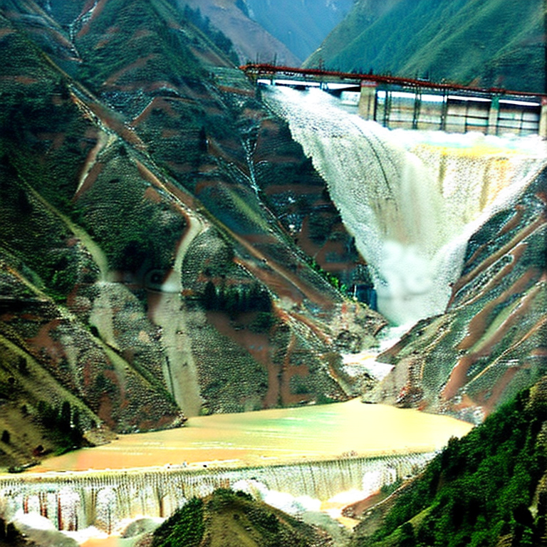
AI generated images of landslide disasters

I have always been fond of both computers and photography, so I am amazed by the awesome capablities of ChatGPT. I also shudder at what AI can do in art, photography and maybe even music.
To learn a little more about AI in photography, I have been tinkering around with playgroundai.com since yesterday. This is a free AI software on the internet.
Placed below are several images I created since then and am shocked how realistic they become as one gains more experience in using the software. I used keywords related to the Himalayas and landslides to generate the first 3 images and then on earthquakes and dams to create the latter two.
Keywords related to Landslides and Himalayas


Keywords related to Earthquakes and dams in the Himalayas


All the above images are as created by AI without my editing them in Photoshop (PS). The quality of the images can certainly be improved:
a. With more practice
b. By editing them in PS
b. Using midjourney.com - but this is not a freeware.

The image below shows how uncannily close to reality the AI image:


Praful Rao
Kalimpong district
Darjeeling-Sikkim Himalaya

Thursday, September 15, 2022

A short documentary on Tanyang Landslides


Continuing our coverage of the landslides in Tanyang village (Samalbung GP, Kalimpong 1) please find a link of a short documentary we have made on the landslide.

https://youtu.be/OQZpNDNktiU 

Praful Rao,
Kalimpong district
Darjeeling-Sikkim Himalaya

Saturday, February 5, 2022

SaveTheHills (STH) activities in 2021 : Raising awareness about Hazards and the Environment by organizing and participating in Webinars, in person Seminars and a Training Program

 One of the main objectives of STH has always been to raise awareness among the general public and also among government officials and others about the hazards and environmental issues of our region and over the years STH has organized and participated in hundreds of workshops, training programs and seminars - all of which are documented in this blog.
In 2021 also we followed this routine except that because of COVID -19 most of our programs had to be online webinars.

Webinars and a Training Program with National Institute of Disaster Management (NIDM)


Webinars with Kalimpong Science Centre

In person Seminar on 'Disasters & Women' and webinar (with DHI)


Besides this STH, being a part of the Darjeeling Himalaya Initiative (DHI) was involved in the many activities involved in hosting SMDS X which is the annual flagship event of the Integrated Mountain Initiative (IMI)

Praful Rao
SaveTheHills
Kalimpong district
Darjeeling-Sikkim Himalaya