Showing posts with label impact. Show all posts

Friday, July 31, 2026

Rainfall data of Jun 2026 of some towns of Sub-Himalayan W Bengal (SHWB) and Sikkim.


Progress of the monsoons (Jun2026)
Technically, the monsoons in India covers the months of June/July/August and September. News paper clips and data which highlight the progress of the monsoon in June 2026 are below:

The monsoons finally arrived over the Darjeeling-Sikkim Himalaya on 10Jun2026 and with it the IMD issued an ORANGE warning (see above) for thundershowers and rain on 10/11Jun2026.
Rainfall in June was initially deficient but picked up towards the last week of June2026:
Extreme rainfall event of 18Jun2026: covered here

IMPACTS 
The impact of the rains was mostly felt after mid-June when the rains intensified and it was mostly limited to roads and infrastructure.The impact at Mirik after the 18Jun2026 rains has already been covered.
News clips on the impact are reproduced below:

Praful Rao
SaveTheHills
savethehills@gmail.com
9475033744

Saturday, April 11, 2026

SaveTheHills photo exhibit on 'The Teesta Valley GLOF disaster - the unheard voices' renewed till April2028 (by Social Documentary Network).

Exactly a year ago, I published a report on the Social Documentary Network (SDN) titled “Teesta Valley GLOF Disaster – The Unheard Voices.”

For those unfamiliar, SDN is a ‘global platform for documentary photographers and visual storytellers, with a strong focus on social, environmental, and human-rights issues, featuring the work of around 3,000 photographers worldwide’ (ChatGPT).

A few days ago, I was notified by SDN that the GLOF exhibit was due for renewal, which involved a fee in US dollars. However, there was also an option to apply for a fee waiver. I’m happy to share that considering our work, SDN has graciously waived the renewal fee until Apr2028.

This means our Teesta Valley GLOF exhibit will continue to remain accessible on a respected international photojournalism platform. I have also updated and refined the exhibit, and it is now available to view here.

I would urge you to take a look and share it further. The disaster remains largely unknown beyond the region, and greater awareness is essential so that the scale of the tragedy—and its continuing impact—is not forgotten.

Praful Rao,
savethehills@gmail.com
9475033744

Sunday, April 13, 2025

Photo - essay on 'The Teesta Valley GLOF Disaster - the unheard voices' featured in Social Documentary Network.

'Social Documentary Network (SDN), founded in 2008, is a global community of documentary photographers, editors, curators, NGOs, students, journalists and others who believe in the power of visual storytelling to build understanding and appreciation for the complexities, nuances, wonders, and contradictions that abound in the world today.'

I had uploaded a photo-essay on the landslides in our region ie 'The Silent Disaster' in SDN , way back in 2011 and since then had almost forgotten about it.

A few days ago, I decided to do a story on the Teesta Valley GLOF Disaster focusing mostly on the social impact ie on individuals and communities rather than on the destruction of bridges, dams and other infrastructure.

After curating the photos, writing up captions and so on, I uploaded 17 images onto the SDN website last night which I am glad, to say have been chosen for display.
The exhibit is 'LIVE' and entitled 'The Teesta Valley GLOF disaster - the unheard voices'


The link to the SDN exhibit is here

I hope this will give the Teesta GLOF Disaster better visibility to a world wide audience.


Do have a look and kindly pass the link to others as well.
The exhibit is best viewed on a laptop in the 'Full Screen' mode.

Praful Rao
SaveTheHills
savethehills@gmail.com
9475033744

Saturday, March 22, 2025

Updated satellite images of Oct 2023 GLOF affected areas from Google Earth

Google Earth has recently (Jan2025) made available high resolution images of some areas of North Sikkim which reveal the devastating impact of the Glacial Lake Outburst Flood (GLOF) of Oct2023 in North Sikkim. The images below juxtapose the affected areas with historical snapshots, illustrating the catastrophic consequences of the GLOF.

Chungthang town / confluence of the Lachen and Lachung Chu

Chungthang (elevation 1790m/5870', 27.62°N 88.63°E), a town in North Sikkim, is situated at the confluence of the Lachen Chu and Lachung Chu rivers, which merge to form the Teesta river.
On October 3, 2023, an avalanche triggered a GLOF in South Lhonak glacial lake (elevation 5200m/17000'), approximately 75km upstream from Chungthang along the Lachen Chu. The resulting sudden release of around 50 million cubic meters of water made it the largest GLOF in the Himalayas in recent history.
For a detailed account of this event, refer to this publication in Science magazine
STH has closely documented the Teesta valley GLOF of Oct2023 in this blog from the date of occurrence.
Satellite images along with photos of the affected areas are placed below:-

Chungthang town (close up)

Chungthang town (Dec2024)
The still devastated playground and army camp area is seen at the center with the gilded dome of the Gurudwara towards the right side.
Chungthang town playground on 19Nov2023 when we visited the area.

The 1200mw Sikkim - Urja dam and bridge at Chungthang

This was the largest dam in Sikkim and was located downstream of the confluence of the Lachen and Lachung Chu rivers. The 60m rockfill, run of the river dam was commissioned in Feb 20217 at a cost of Rs 14,000crores. Along with the dam, a major bridge (centre top of photo) connecting Chungthang to the rest of Sikkim was also destroyed by the GLOF.
The remnants of Sikkim Urja dam which collapsed in the GLOF on 04Oct2023. Photographed on 18Nov2023, when we visited Chungthang.
A double laned concrete bridge connecting Chungthang to the rest of Sikkim was destroyed by the GLOF here on 04Oct2023

Munshithang (27.6324° N 88.6157° E)

Munshithang, an ammo depot for the Indian army was totally destroyed by the 04Oct Teesta Valley GLOF. On receiving warning of the rising waters in the Lachen Chu, 92 personnel of the ammo depot moved to  higher ground and thus their lives were saved. However, it was 4 days before they could be evacuated - due to bad weather which prevented helicopter flights.
Nothing could be retrieved of the ammunition and equipment lost to the GLOF.

Toong bridge over the Teesta river  (27°33'0.15"N 88°38'35.17"E)

We visited this area on 19Nov2023 and photographed the bridge and the Toong checkpost both of which were destroyed by the GLOF (below)

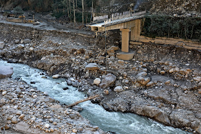
There was only a small bamboo bridge across the Teesta for pedestrians to cross the river on foot in Nov2023
The Toong police checkpost had been vacated and dangled precariously from the edge of the road
Another view of the vacated police checkpost in Nov2023
Faced with the sheer necessity of communicating, the local community start constructing a wooden bridge across the Teesta at Toong.

 Naga Gram Panchayat (Mangan district, North Sikkim)

Naga GP is located approx 14km from Mangan (district HQ of N Sikkim district) towards Toong and was one of the worst affected areas when we visited Chungthang on 19Nov2023.

It continues to be a wrecked and desolate place as can be seen from the recent photos (of Dec2024) below (photo credits: Rinchen Lama, IIHS ,Bangalore)
Google Earth has unfortunately not updated satellite images of areas south of Naga area (North Sikkim) which are still of 2022 vintage as such they do not show the impact of the GLOF in these areas.


Praful Rao
SaveTheHills
savethehills@gmail.com
9475033744

Friday, January 31, 2025

The Oct 2023 Teesta Valley GLOF disaster gets its due recognition: An article published on the disaster in SCIENCE MAGAZINE

The GLOF sweeping past the Teesta bazar (W Bengal) on 04Oct2023. This drone photo by Praveen is certainly one of the most iconic images of a GLOF.

The SCIENCE MAGAZINE (https://www.science.org) is widely recognized as the world's most prestigious journal on science, publishing the very best in research across the sciences, with articles that consistently rank among the most cited in the world. It is published by the American Association for the Advancement of Science (AAAS), the world’s oldest and largest general science organization.
Dr Ashim Sattar (IIT Bhubaneshwer) is a glaciologist who has done a huge amount of research on the South Lhonak glacial lake and had almost predicted accurately the GLOF which occurred on 03/04Oct2023. I have quoted extensively from his write up earlier in this blog and had the good fortune of meeting him at Chitrey, in the Teesta valley last year when he was enroute to Gangtok, Sikkim.

With Ashim (left) on 21Feb2024 at Chitrey
In our brief interaction, he mentioned he was working with many world experts on a paper on the 03/04Oct2023 Teesta Valley GLOF disaster which I daresay was all but ignored by government and the media even  though it was the largest GLOF disaster in the Himalayas in the recent past.
Since then I have personally had many interactions with him, shared photographs of the GLOF and affected areas and discussed the impact at the many places we had visited while recording the GLOF.
Even though I am unaware of the technical details of the mammoth work that Ashim and all the associated scientists have put in, I know getting it published in Science Magazine was another huge challenge and it took months of meticulous work by Ashim with literally many emails being exchanged between all of us.
The full article published by SCIENCE MAGAZINE yesterday, is here (https://www.science.org/doi/10.1126/science.ads2659)
In addition, Dr Dave Petley, VC Univeristy of Hull (UK) who is one of the co - authors has published his synopsis of the whole article - which is here (https://eos.org/thelandslideblog/sikkim-glof-october-2023)
My grateful thanks to Dr Ashim Sattar and all the eminent scientists who devoted so much time and effort towards this article.

Praful Rao
SaveTheHills
savethehills@gmail.com
9475033744


Monday, October 7, 2024

Rainfall data of Sep 2024 of some towns in Sub-Himalayan W Bengal and Sikkim

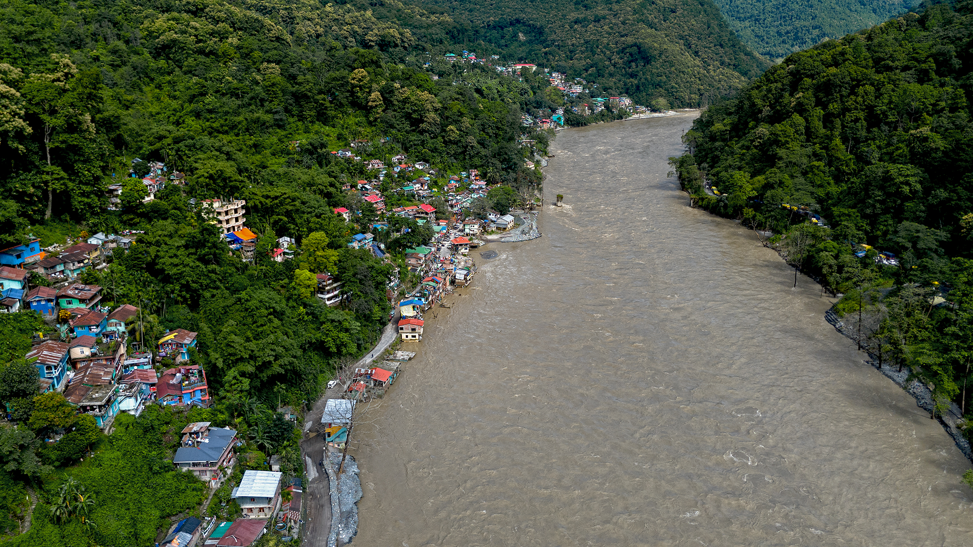
Teesta river and bazar on 29Sep2024, a few days after heavy rain on 27/28Sep. The river had receded quite a bit yet it flowed nudging the bazar and the Darjeeling road at many places. The river is still swift and flows from one bank to the other.
Notice the way the heavy rain is all stacked up in the last week of the month with the first few weeks being deficient in rain.
A dramatic shift from deficient rain upto 25Sept followed by a large surplus thereafter.


The impact of the heavy rains in the month end has already been covered in a separate post here


Praful Rao
SaveTheHills
9475033744
savethehills@gmail.com

Monday, August 12, 2024

Rainfall data of July 2024 of some towns in Sub-Himalayan W Bengal and Sikkim

IMPACT OF THE JULY 2024 RAINS AT TEESTA BAZAR:
Some young men at Teesta bazar had started a two wheeler repair business in this shop on the Darjeeling-Kalimpong road after they shovelled out all the sand and debris brought in by the 04Oct2023 disaster (notice the damaged ceiling fans). The rains of July2024 put an end to their business venture and dreams when the Teesta river, flowing in the vicinity and almost at the same level flooded their shop again during heavy rains.


Rainfall normally peaks in July during the monsoons after which the rainfall gradually declines in August and Sept with the monsoons normally exiting our region in October.
As is clearly visible from the top data, rainfall was heavier in the Dooars area and foothills of Kalimpong district (and Bhutan hills).
IMPACT
The amount and intensity of rainfall impacted road communication a lot with NH10 and the Darjeeling - Kalimpong road being closed OFF and ON thru the month.
Even Rohini road to Darjeeling from Siliguri was closed for some time on 02Jul2024

                                Landslide near Loreto School, Darjeeling - 05July2024

INFACT NH10, WHICH HAD CLOSED ON 01JULY2024, COULD NOT BE RE-OPENED FOR TRAFFIC UNTIL 31JULY2024 - WHICH WAS THE LONGEST DURATION THAT THE HIGHWAY WAS CLOSED CONTINUOUSLY EVER - ALL DUE TO THE TEESTA VALLEY GLOF OF 04OCT2023.
Landslide on NH10, at Andheri, near Rangpo on 16July2024.
A low pressure area in the Bay of Bengal which brought in a drier spell of weather in our region after the heavy rains in the first half of July2024.
My thanks to all our What's App group ('Hazard Alerts') members whose images and stories I have used in this post

Praful Rao
with
Yukta Acharya

SaveTheHills
Kalimpong district
Darjeeling-Sikkim Himalaya
savethehills@gmail.com
9475033744