Saturday, June 10, 2023

STH activities in early Jun2023.

03Jun2023

Commencing 02Jun2023, four IIT (Mandi) students are interning with SaveTheHills for around a month, so our activities have been interwoven with their training schedule.
For their benefit as well as for the students of Cluny Women's College, Kalimpong, we asked renowned academic Prof Sarah Besky of Cornell University (who was Kalimpong for her own research work) to talk about the 'Impact of tourism on Rural Communities'


05Jun2023: World Environment Day (Theme: Solutions to Plastic Pollution)

Along with AIWC (Kalimpong Branch) we organized an awareness program in DISHA Center, Kalimpong:


07Jun2023: Study tour to the NHPC's Teesta Low Dam Project III with 11 students (of IIT - Mandi and Siliguri College)


My thanks to Prof Besky, Cluny Women's College, AIWC (Kalimpong) and NHPC for making the events memorable.

Praful Rao
Kalimpong district
Darjeeling Sikkim Himalaya
savethehills@gmail.com
9475033744

STH Stormwatch: Cyclone 'Biparjoy' in the Arabian sea and a 'well marked low' in the Bay of Bengal


Praful Rao
Kalimpong district
Darjeeling - Sikkim Himalaya.
savethehills@gmail.com
9475033744

Sunday, May 28, 2023

STH Stormwatch :A tale of two cylones - in May2023.

STH has been tracking and reporting on storms for more than a decade even though now we report largely on a What'sApp group called 'Hazard Alerts'.
In May2023, the very quiet seas in the Bay of Bengal and eastern Pacific suddenly became active and brewed several big storms.
Cyclone 'Mocha' which formed in the Bay of Bengal around 08May2023 and we tracked and reported on the storm extensively:-

As I write Typhoon 'MAWAR' has formed in the eastern Pacific but is likely to weaken from a Super Typhoon to a severe tropical storm as is nears land.

Praful Rao
Kalimpong district
Darjeeling - Sikkim Himalaya
savethehills@gmail.com
9475033744

Friday, May 5, 2023

AI generated images of landslide disasters

I have always been fond of both computers and photography, so I am amazed by the awesome capablities of ChatGPT. I also shudder at what AI can do in art, photography and maybe even music.
To learn a little more about AI in photography, I have been tinkering around with playgroundai.com since yesterday. This is a free AI software on the internet.
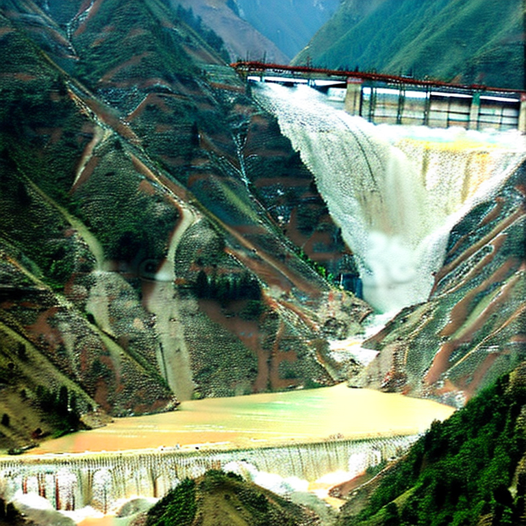
Placed below are several images I created since then and am shocked how realistic they become as one gains more experience in using the software. I used keywords related to the Himalayas and landslides to generate the first 3 images and then on earthquakes and dams to create the latter two.
Keywords related to Landslides and Himalayas


Keywords related to Earthquakes and dams in the Himalayas


All the above images are as created by AI without my editing them in Photoshop (PS). The quality of the images can certainly be improved:
a. With more practice
b. By editing them in PS
b. Using midjourney.com - but this is not a freeware.

The image below shows how uncannily close to reality the AI image:


Praful Rao
Kalimpong district
Darjeeling-Sikkim Himalaya

Thursday, May 4, 2023

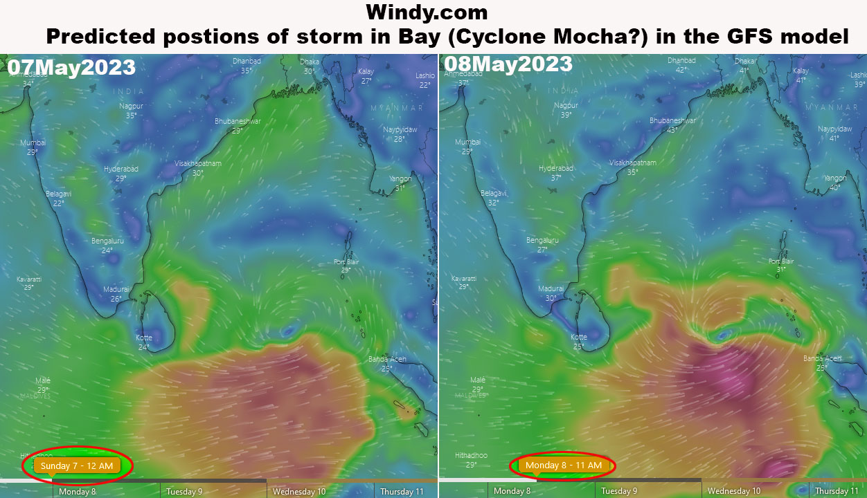
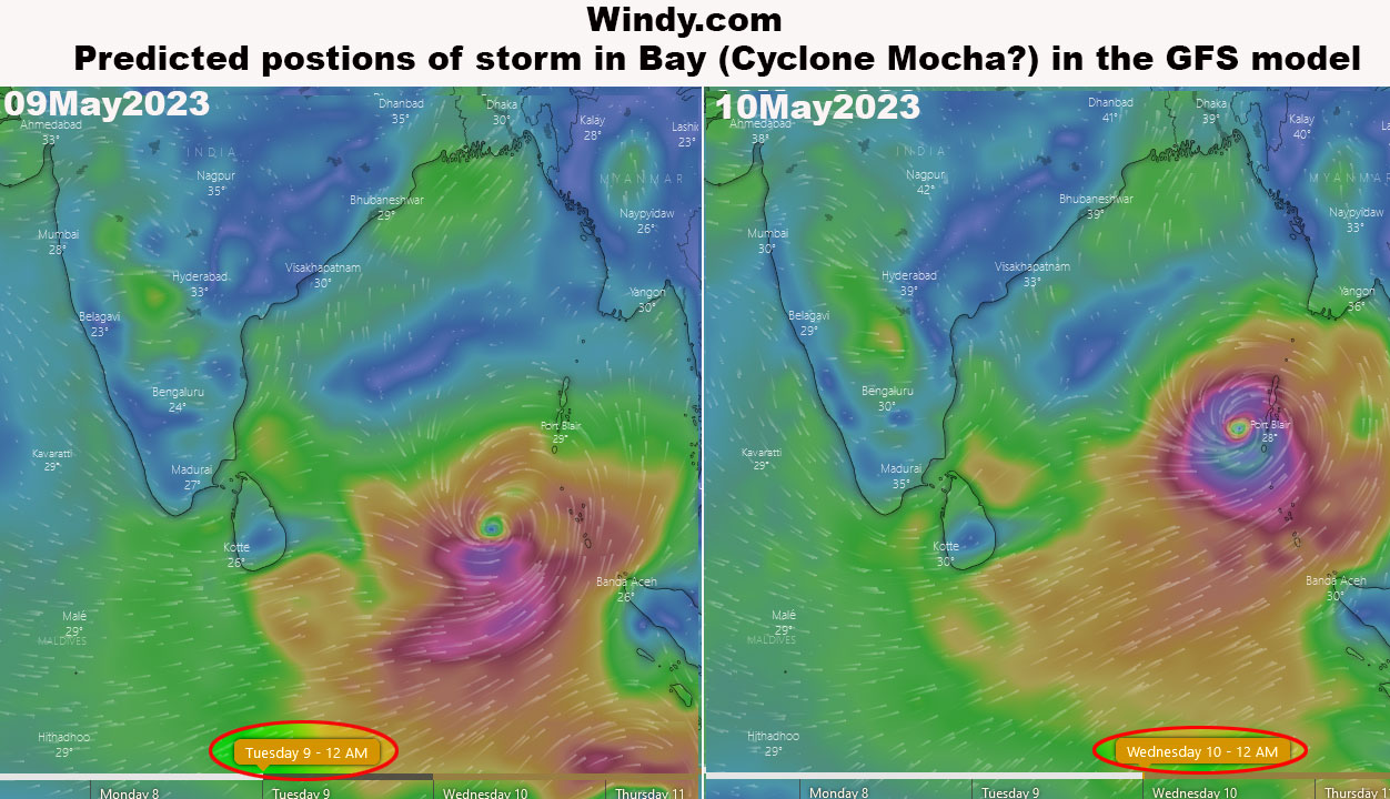
Early Warning: Forecast (GFS Model) positions of storm in the Bay of Bengal from windy.com

The first cyclone of 2023 (Cyclone MOCHA) is expected to form in the Bay of Bengal in a few days.
Forecast positions of the storm (using the GFS model) have been published by windy.com.
Placed below are the forecast positions from the website.


Please check
a. Regional Specialized Meteorological Centre for Tropical Cyclones (https://rsmcnewdelhi.imd.gov.in/rsmc-tropical-cyclones.php)
b. https://mausam.imd.gov.in/responsive/cycloneinformation.php
c. US Navy's Joint Typhoon Warning Centre website (https://www.metoc.navy.mil/jtwc/jtwc.html)
for more accurate forecast track later when the storm forms in the Bay of Bengal

Praful Rao
Kalimpong district
Darjeeling Sikkim Himalaya

Monday, May 1, 2023

STH at the C20 (Civil-20) Conclave in Gangtok (Sikkim) on 30April2023

In Dec 2022, India assumed the Presidency of G20 which is a group of 20 nations which have come together to address some of the major issues of the world. In this C20 or Civil 20 is one of the many engagement groups which will forward its policy recommendations later in the year to the G20 group for consideration.
What is the C20?
Well, C20 provides a platform to Civil Society Organizations of countries in the G20 group to voice their perspectives on the many issues in which civil society has a role. In this regard, the Chair of C20 is Amma ((Sri Mata Amritanandamayi Devi) and a Conclave on 'Sustainable and Resilient Communities' was organized by the Amrita Organization along with the Govt of Sikkim on the 29/30April at Chintan Bhavan in Gangtok, SIkkim.

Responding to a Call for Submissions by the C20 group, STH submitted a 3 slide presentation to the organizers for the Conclave on 'HAZARD ALERTS', a What's App group which STH formed 6 years ago in order to disseminate hazard warnings and information to the Grass Roots in the Darjeeling-Sikkim Himalaya
We also submitted a short video on 'HAZARD ALERTS'

I am glad to inform you that our submission was selected as one of the 20 BEST PRACTICES(Udaharans) to be submitted to the G20 later this year for consideration and I had the privilege of speaking at briefly about 'Hazard Alerts' yesterday at the Chintan Bhavan.

Praful Rao
Kalimpong district
Darjeeling- Sikkim Himalaya
savethehills@gmail.com
9475033744

Friday, April 14, 2023

STH activity on 15th and 21April2023


Whereas the meeting on 15Apr2023 (Alpine University, Namchi, Sikkim) is a virtual one, the second meeting with Darjeeling Himalaya Initiative on 21Apri2023 will be held in person in Darjeeling.

Praful Rao
Kalimpong district
Darjeeling-Sikkim Himalaya
savethehills@gmail.com
9475033744

Wednesday, April 12, 2023

Water shortage in the Third Pole: Bhalukhop Village, Kalimpong

STH has blogged about water scarcity in the rural areas earlier (kindly read 1) and we have a reference to Spring Shed rejuvenation program which was tried out in Kalimpong.

Praful Rao
Kalimpong district
Darjeeling -Sikkim Himalaya

Wednesday, March 29, 2023

SaveTheHills survey of landslides near Dikchu (East Sikkim) on 27Mar2023


LANDSLIDE 2

Following media reports on a major landslide occurrence at Sokpay, near DIKCHU on 26Mar2023, we made a quick visit to the region the next day. Our report:

Rainfall data for the month of MARCH of Mangan (District HQ of North Sikkim)
2021 - 249.9mm
2022 - 166.5mm
2023 - 272mm (upto 28Mar2023)
Dikchu is situated approx 2.5km (approx 21km by road) south of Mangan.

Location and Co-ordinates of the base (toe) of landslide
The landslide at Sokpay (Rakdong-Tintek block) is huge with the crown located at least 1500' above the toe. We could only survey the base (toe) of the landslide which is located very close to DIKCHU town because the landslide has cut off access to the higher reaches where several affected homesteads are located.
Co-ordinates and elevation: N27° 23.822' E88° 31.142'
Elevation: 2543ft (775m)

Brief history and date and time of occurrence
As per locals, the landslide at Sokpay took place between 3-4am on 26Mar2023.
However, they trace back the instability to 2016 when there was a landslide in the area and thereafter, smaller landslides taking place at regular (even yearly) intervals; with 'surveys' being conducted and talks of relocation also taking place but nothing being implemented.

Probable cause
This seems to be a mystery since there has been very little rainfall in this region since Oct2022. In Mar2023, Mangan and Gangtok region did receive 'excess' rainfall (see below)
But this amount and intensity of rainfall, in our experience does not trigger such a large landslide. Local people are quick to point out that it is NHPC's Stage V Dam on the Teesta river located at Dikchu as a cause and also the large power towers (pylons) at the top (crown) of the landslide as the probable trigger.
However, there is no study done to prove this.
Government officials are equally fast in saying the entire investigation is being done by the Department of Mines and Geology, Govt of Sikkim and that their report on the cause and remedial measures to be taken is awaited. They also point out that this area is landslide prone with many sinking zones - which even a cursory look at the region will prove as correct.
We also found no other evidence of large scale and recent human interference such as road/tunnel construction which could have triggered the landslide. Nor was there any erosion by a jhora or river in the close vicinity which could have caused erosion and triggered the  landslide which started from the hilltop.

Casualties and damage
There were no human lives lost even though the farmers lost cattle and pigs in the slide. 4 homes were totally damaged and 20 families have been shifted to temporary relief shelters by the government. Unlike the landslide in Pathing, both the media and government authorities seem to have mobilized immediately. The Government has implemented relief measures and also taken the help of the Power Companies to provide temporary rehabilitation to the affected families.
Road communications from DIKCHU to GANGTOK has snapped and the main road from DIKCHU to MANGAN may also be affected in case the landslide is reactivated during the oncoming monsoons.


LANDSLIDE 1

We discovered this landslide at Tumin Shelay, in the same area almost by accident. This huge landslide is more than a year old and seems to have been triggered by rain in an agricultural area. The farmers have lost almost 3 acres of paddy field there and around 3-5 families have been compelled to relocate. A local person guided us to the landslide which has affected the lives of the farming community in more ways than one - tourism which was coming up around a beautiful waterfall in the vicinity has died a premature death.
Like many landslides which occur in remote areas, this one never hit the headlines - in fact, I had never even heard about it, until we reached the place searching for the recent DIKCHU slide.

Location and Co-ordinates of landslide
Located at Tumin Shelay village.
Co- ordinates near the crown: N27° 19.492' E88° 30.134'
Elevation: 4082ft (1244m)


We will be uploading a short documentary, on our visit to these landslide sites. The documentary will include interviews, images and drone footages of the landslides.

Praful Rao
Kalimpong district
Darjeeling-Sikkim Himalaya
9475033744
savethehills@gmail.com


Sunday, March 5, 2023

Silences and biases in media and academic reporting of Landslide Disasters

I recently came across a study done primarily on major US media networks titled 'How many deaths does it take for a disaster to receive news coverage' (Source: Eisensee and Stromberg (2007)). The two authors found out that for every person killed by a volcano 882 people have to die of landslides to receive the same coverage in US televised news. This creates dangerous biases and affects the attention given to landslides as a disaster. Disasters like landslides are less 'spectacular', with fewer dramatic stories and therefore not documented. Though the data is for the US media networks there are many examples of how landslides have been ignored in our region as well. To refer to a recent instance, we documented how the landslide in Pathing was overlooked for over 3 months which caused severe distress to the lives and livelihood of the people there. You can view the videos here.


Location is also a bias which is talked about in this article, where developed nations like Europe and America get way more coverage than the rest. 

I performed a simple search on Google, taking The Times Of India as a case study, with the keywords 'Landslides in The Pune Times of India' vs Uttarakhand, Darjeeling and Mizoram. The results clearly show the discrimination in media reports, where importance has been given to developed regions yet again.


In the image above I have placed these results on a landslide hazard zonation map of India given by BMTPC, Government of India to show how severe to high risk zones in the North East are reported vs the high, moderate to low developed areas, which are reported almost triple times more.

The results in descending order are:
Uttarakhand: 1573 news articles
Pune: 755 news articles
Darjeeling: 198 news articles
Mizoram: 169 news articles

Not only is it hidden in media but also in the academic front. Given below are statistics of the biased distribution of landslide studies done across the Himalayan region (Abhirup et.al 2020), where the Western Himalayas has been given a larger chunk of the academic pie than the North East Himalayas. The author attributes this bias to the a higher population density and a higher level of landslide risk there. 


We see that there are global, national and regional biases when it comes to disasters in general. Landslides are unique because we have biases locally as well. This bias comes with what is seen easily, landslides on the roads. Most of the studies done here are on landslides on NH10 or NH55. It is easily accessible, causes a lot of problems for a larger mass and hampers development. What is ignored then are the smaller landslides. A famous quote by our president is that 'Landslides nibble'. They nibble their way into farmlands, (we have a detailed report on the Nimbong landslide problem where acres of farmland has just disappeared due to landslides) homes, creating sinking or unstable zones where people have no other option but to relocate.

According to GSI, 12.6% of India's landmass is prone to landslide hazard. Landslides are unique in nature as they are the only disasters that take away a person's land. Our region is extremely vulnerable to these biases because we are not only the victims of disaster discrimination but also the victims of spatial discrimination. These biases must be accounted for in the Landslide Risk Zonation Maps to get an accurate view.

We face a silent disaster therefore are unheard; its impact slow though debilitating therefore ignored; and distant therefore unseen. 

Shreya Gurung,
Kalimpong district
Darjeeling- Sikkim Himalayas
savethehills@gmail.com
9475033744