Showing posts with label jhora. Show all posts

Sunday, September 13, 2020

Landslide Report 3 (Kalimpong) - Sep2020

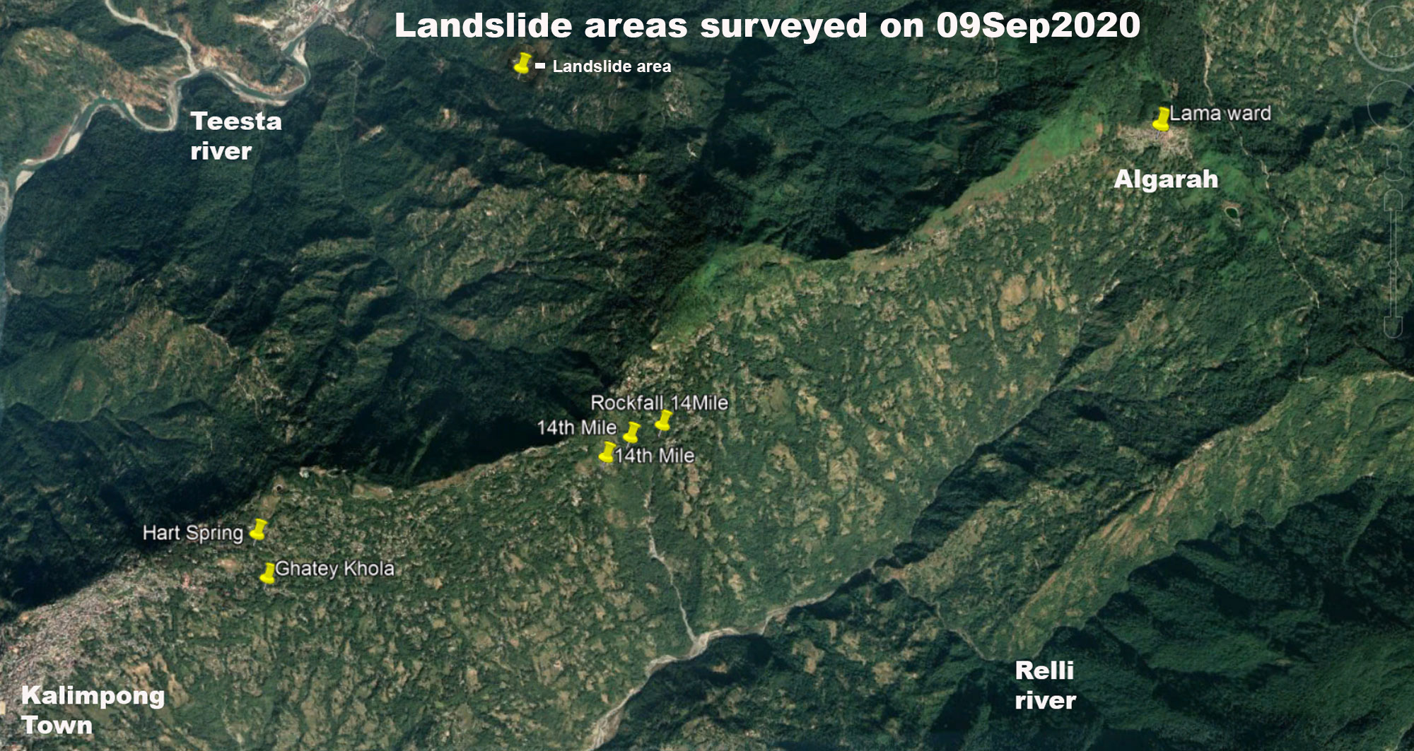
Continuing with the landslide surveys (See Report 1 and Report 2 in this blog)  around Kalimpong town, on 09Sep2020, we went to the north eastern sector of Kalimpong along Reshi Road upto ALGARAH. This road is of strategic importance to India since much of the logistics for the Indian army in East Sikkim (opposite Doklam) goes thru this road. Also in case of NH10 being blocked, this road, via Lava/Gorubathan serves as the alternate route to Siliguri.
Regarding the survey:
  • Besides the landslide/subsidence zones mentioned below, what was very evident was the serious deterioration in the condition of the Kalimpong -Algarah section of Reshi road with numerous sinking areas visible on many parts of the road, where another heavy shower or two could result in collapse of the road at multiple places.
  • What should be also noted here is that the entire region has many natural springs and jhoras which during heavy rain causes a lot of erosion and landslides in the area.
  • STH has recorded the extreme rainfall events of AUGUST 2020 and their effects in earlier posts (see 1 and 2). Further the rainfall of August 2020 is also available in this blog. All the landslides recorded below were the result rainfall during the extreme rainfall events.
GHATEY KHOLA subsidence

Coordinates: 27° 4'42.00"N, 88°29'50.88"E
Size of subsidence of road : approx 45m in length
During periods of intense rain, Ghatey Khola is notorious for causing landslides in this area since the runoff from the entire populated areas at the crest of the hill finds its way into this drain.
14th Mile sinking zones
The 14th mile sinking areas have been featured in this blog numerous times (see 1 and 2) and are one of the oldest landslide zones in Kalimpong. During the heavy rains of August 2020, these areas were re-activated at almost the same locations causing large portions of the Kalimpong- Algarah road (Reshi Road) to subside.
No other damage to farmland or infrastructure was observed.


Sinking areas of Algarah town
Algarah town is approx 15 kms NE of Kalimpong and has a long history of landslides. I had visited the area some years ago and marked out the sinking areas (above). WIth less rainfall in the past few years, the landslide and sinking zones had also diminished. This year with the intense rains that we have had, the hotspots have re-emerged and perhaps the most crucial one is the one in LAMA WARD which is located in the centre of Algarah town.

Coordinates: 27.1172° N, 88.5837° E
Landslide at HART spring, Dr Graham's Homes, Kalimpong

Coordinates: 27° 4'56.22"N, 88°29'48.48"E 

Photo credits: Ms Shreya Gurung

Praful Rao,
Kalimpong district
Darjeeling- Sikkim Himalaya

Monday, May 3, 2010

The 14th Mile Landslides in Kalimpong revisited -02May2010

I have covered the 14th Mile landslide problem (here) at Kalimpong earlier in 2007 .
On 02May2010, I was invited by village people of the area to have a detailed look at the area again. What we did was walked all the way form the top (GPS Waypoint 41) to the base of the natural rivulet (GPS Waypoint 47) which is the cause of the instability in the area. During the course of the 5hr walk we interacted with affected people of the area and saw what has now become a familiar sight - farmland which has disappeared, homes which are cracked and despair written on the faces of people.
Even though this problem has been persisting for many decades now, nothing has been done to mitigate or otherwise control this hazard as such now it seems virtually uncontrollable.