
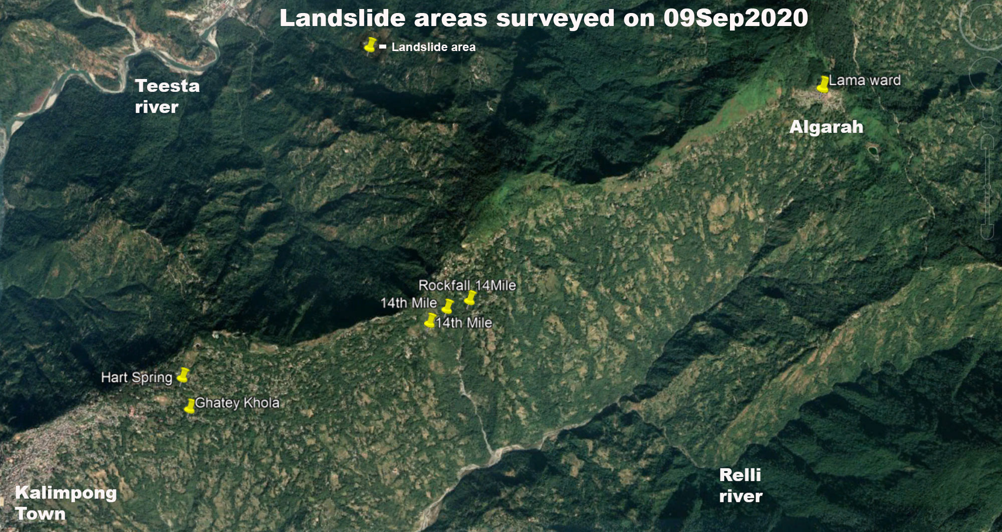
Regarding the survey:
- Besides the landslide/subsidence zones mentioned below, what was very evident was the serious deterioration in the condition of the Kalimpong -Algarah section of Reshi road with numerous sinking areas visible on many parts of the road, where another heavy shower or two could result in collapse of the road at multiple places.
- What should be also noted here is that the entire region has many natural springs and jhoras which during heavy rain causes a lot of erosion and landslides in the area.
- STH has recorded the extreme rainfall events of AUGUST 2020 and their effects in earlier posts (see 1 and 2). Further the rainfall of August 2020 is also available in this blog. All the landslides recorded below were the result rainfall during the extreme rainfall events.


Coordinates: 27° 4'42.00"N, 88°29'50.88"E
Size of subsidence of road : approx 45m in length
During periods of intense rain, Ghatey Khola is notorious for causing landslides in this area since the runoff from the entire populated areas at the crest of the hill finds its way into this drain.
14th Mile sinking zones
The 14th mile sinking areas have been featured in this blog numerous times (see 1 and 2) and are one of the oldest landslide zones in Kalimpong. During the heavy rains of August 2020, these areas were re-activated at almost the same locations causing large portions of the Kalimpong- Algarah road (Reshi Road) to subside.
No other damage to farmland or infrastructure was observed.


Landslide at HART spring, Dr Graham's Homes, Kalimpong

Coordinates: 27° 4'56.22"N, 88°29'48.48"E
Photo credits: Ms Shreya Gurung
Praful Rao,
Kalimpong district
Darjeeling- Sikkim Himalaya
No comments:
Post a Comment