Showing posts with label algarah. Show all posts

Sunday, September 13, 2020

Landslide Report 3 (Kalimpong) - Sep2020

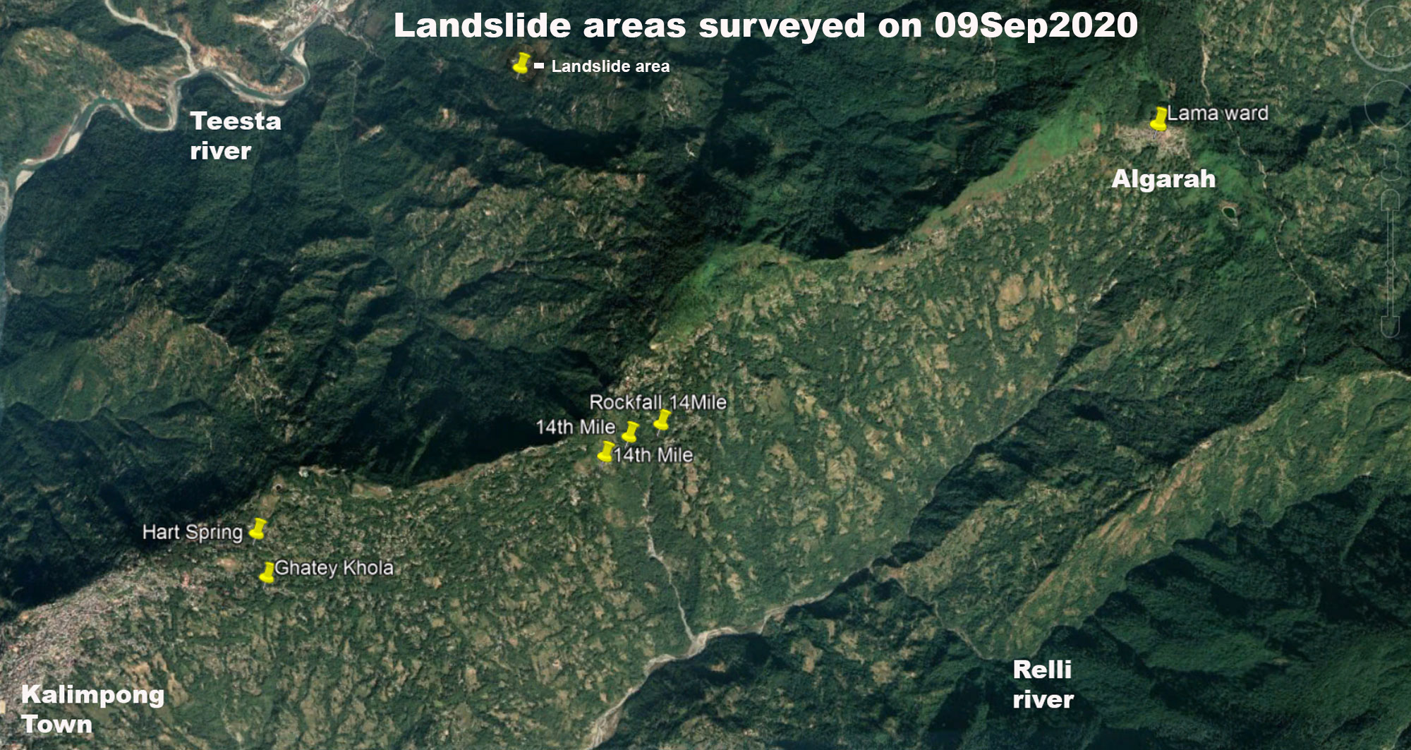
Continuing with the landslide surveys (See Report 1 and Report 2 in this blog)  around Kalimpong town, on 09Sep2020, we went to the north eastern sector of Kalimpong along Reshi Road upto ALGARAH. This road is of strategic importance to India since much of the logistics for the Indian army in East Sikkim (opposite Doklam) goes thru this road. Also in case of NH10 being blocked, this road, via Lava/Gorubathan serves as the alternate route to Siliguri.
Regarding the survey:
  • Besides the landslide/subsidence zones mentioned below, what was very evident was the serious deterioration in the condition of the Kalimpong -Algarah section of Reshi road with numerous sinking areas visible on many parts of the road, where another heavy shower or two could result in collapse of the road at multiple places.
  • What should be also noted here is that the entire region has many natural springs and jhoras which during heavy rain causes a lot of erosion and landslides in the area.
  • STH has recorded the extreme rainfall events of AUGUST 2020 and their effects in earlier posts (see 1 and 2). Further the rainfall of August 2020 is also available in this blog. All the landslides recorded below were the result rainfall during the extreme rainfall events.
GHATEY KHOLA subsidence

Coordinates: 27° 4'42.00"N, 88°29'50.88"E
Size of subsidence of road : approx 45m in length
During periods of intense rain, Ghatey Khola is notorious for causing landslides in this area since the runoff from the entire populated areas at the crest of the hill finds its way into this drain.
14th Mile sinking zones
The 14th mile sinking areas have been featured in this blog numerous times (see 1 and 2) and are one of the oldest landslide zones in Kalimpong. During the heavy rains of August 2020, these areas were re-activated at almost the same locations causing large portions of the Kalimpong- Algarah road (Reshi Road) to subside.
No other damage to farmland or infrastructure was observed.


Sinking areas of Algarah town
Algarah town is approx 15 kms NE of Kalimpong and has a long history of landslides. I had visited the area some years ago and marked out the sinking areas (above). WIth less rainfall in the past few years, the landslide and sinking zones had also diminished. This year with the intense rains that we have had, the hotspots have re-emerged and perhaps the most crucial one is the one in LAMA WARD which is located in the centre of Algarah town.

Coordinates: 27.1172° N, 88.5837° E
Landslide at HART spring, Dr Graham's Homes, Kalimpong

Coordinates: 27° 4'56.22"N, 88°29'48.48"E 

Photo credits: Ms Shreya Gurung

Praful Rao,
Kalimpong district
Darjeeling- Sikkim Himalaya

Friday, July 15, 2016

STH Activities : Landslide Survey on the eastern flanks of Kalimpong (14July2016)

 14th Mile Landslide
The 14th mile 'sinking zone' lying on the eastern face of the Kalimpong ridgeline is one of the old landslide areas of this town. It is repaired on annual basis and is rumored to be a "blessing" to many a contractor - except that now with population growing and even a posh hotel coming up directly above this site, it will also be a curse to quite a few.
When I visited the site on 14Jul2016, I found that a portion of the road to Algarah had sunk considerably (slide 'A') and worse still the culvert next to it had also sunk (slide 'B') - and ALL the water from the culvert was percolating into the crack (slide 'C') acting as a lubricant to an unstable hillside ready to slide down.
Coordinates :
27°05´27.6” N
088°31´57.0”E
Elevation : 1372m
Landslide blocking Kalimpong - Lava Road
With our main road to the external world, NH10 always in a precarious state during the monsoons, we rely on the Kalimpong- Lava- Gorubathan road as our an alternate route to the plains. Unfortunately, this road also has quite a few 'hotspots' which keep the BRO busy during the monsoons.
On Sunday, 10July2016 at around 1600h, following the 125mm rainfall of Saturday, a portion of this road near Rickisum gave way. It remained blocked for 4 days and effectively cut off Lava and much of the eastern parts of sub-division from Kalimpong town.
Coodinates :
27°05´49.5”N
088°36´22.6”E
Elevation : 1804m

Praful Rao,
Kalimpong,
Dist Darjeeling