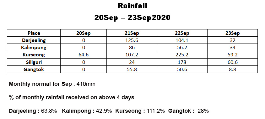
The above rainfall followed the formation of a LOW pressure area in Bay of Bengal around the 20Sep
21Sep2020 images
In the morning, we had a report in 'Hazard Alerts' our WA gp of extremely heavy rainfall on NH 10 and very soon this image of the flooded bridge (Coordinates 26.9832971E 088.417920N) at RAMBI (Kalimpong) was also posted.👇
Rambi was a small, sleepy town known mostly for the local mushroom production till recently- the construction of a dam
(TLDP III) and the
IRCON Sevoke-Rangpo Broad Gauge railway tunnel work have added prominence to the place.
Almost simultaneously reports of Mirik (Darjeeling district) experiencing torrential downpours came in and this image showing an ☝ area of Mirik town (coordinates 26.8853° N, 88.1828° E) near the lake was posted. It resembles a flooded place in the plains.
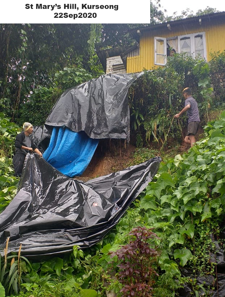
22Sep2020 images
Damage on National Highway (NH)10
SETI Jhora landslide (Coordinates 26.93946N 088.44148E, Elvn 233m)
This ☝ gaping hole on NH10 was due to toe erosion by the Teesta river on 23Sep2020 at Seti Jhora . This spot has always been a
major maintenance challenge on NH10 and has been responsible for several fatalities in the recent past.
Sign diverting highway traffic put up at Teesta after landslides blocked the NH10 at 29th mile 👇 on 22Sep2020.
29Mile Landslide (Coordinates 27.01435N 088.43594E, Elvn275m)The scene was in fact worse in the plains of North Bengal 👇 as can be seen in the image from Cooch Behar (26.323921N89.451088E)
My thanks to all those who contributed the photos, reports etc via WhatsApp and in our group (Hazard Alerts) for us to maintain a record of the event for posterity,
Praful Rao
Kalimpong district
Darjeeling-Sikkim Himalaya


No comments:
Post a Comment