Tuesday, October 15, 2024

Importance of real-time weather information in hydrological disasters: Need for more AWS

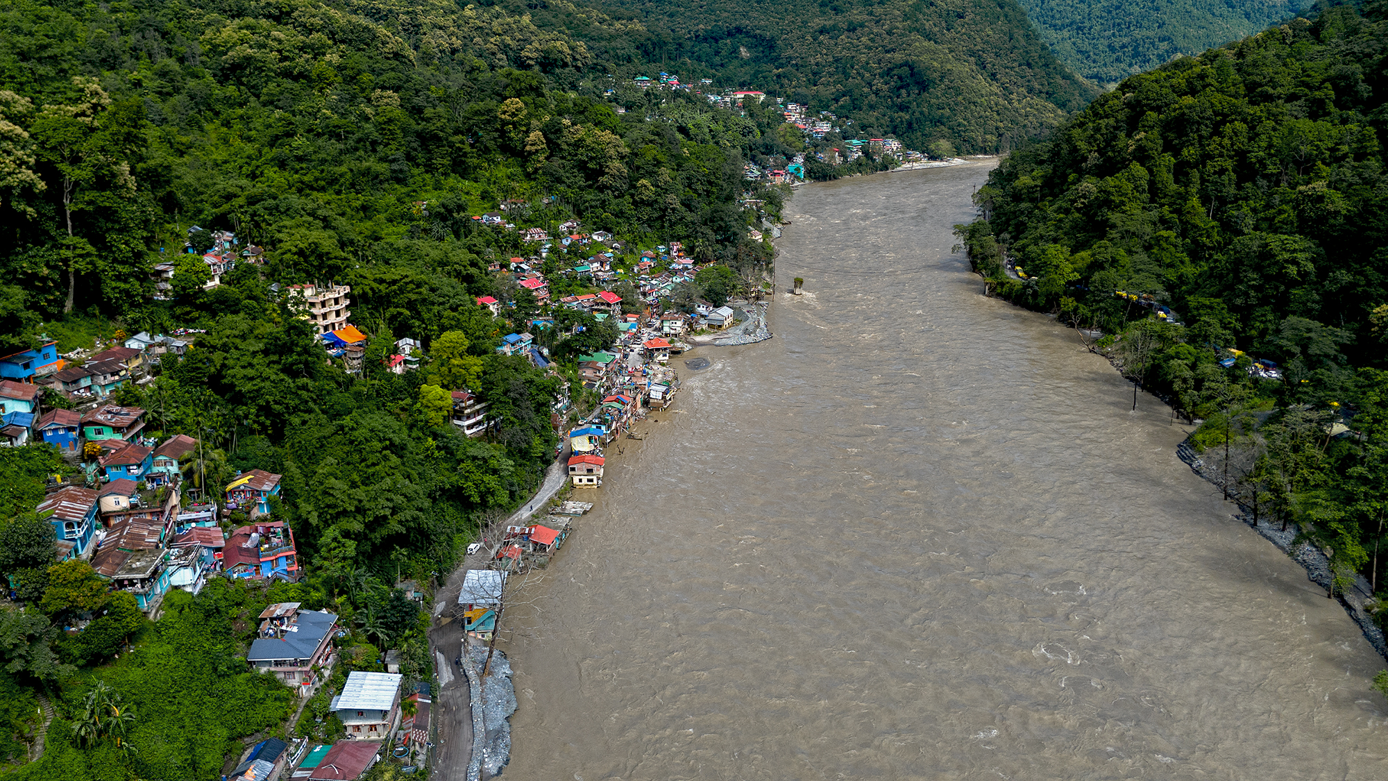
We, at SaveTheHills have long realized the importance of real-time weather inputs especially in the Himalayas where weather can change quickly and with devastating consequences.
In this regard, 'Hazard Alerts', our WhatsApp based social media group in this region, does precisely that - disburse verified information on weather and updates on forecast heavy rain, hazards such as landslides, road closures to the community in the quickest time and I am extremely happy to state that all three WhatsApp groups (Hazard Alerts 1,2, 3) and our other social media handles in Instagram, FB and so on, have today emerged as disciplined, powerful community driven platforms, which share such information and help each other using reports from individual members, satellite images of clouding, lightning app reports, social media posts and so on.

STH has also encouraged and helped in establishing a network of online AWS in this region so that real-time information from these stations is available to the community as well as disaster management people of this region:


I was keeping a track of Hurricane 'Milton' recently, and was able to monitor the rainfall data of several places around Tampa , Florida from my home in the Himalayan foothills as the storm wreaked havoc there. I accessed the weather in real-time on the Weatherlink app for Davis automatic weather stations in the area.

It is amazing to see how powerful technology is these days and I was particularly impressed to see the density of DAVIS AWS which are available at the Tampa bay area, probably because this area is prone to hurricanes and heavy rain/storm surges.

Real-time data on rainfall intensity and high-velocity winds can play a crucial role in warning communities about potential landslides and flooding. This allows for timely evacuations, prioritization of relief efforts, and ultimately, saving lives. It also allows preservation of valuable weather data of the region.

To maximize early warning systems, information from Automatic Weather Stations (AWS), satellite imagery, lightning reports from apps like Weatherbug and Damini, and even social media should be fully utilized. This is especially critical as climate change and warmer oceans are causing extreme weather events to become more intense, unpredictable, and accompanied by increased rainfall.

While I specifically mention DAVIS AWS, as we’ve successfully used this equipment for 6-7 years, there are undoubtedly many other reliable brands. The key requirement is that weather data must be available online with frequent updates.

For instance, the India Meteorological Department (IMD) has an AWS site that I found helpful during the 2024 monsoon season. However, the site’s updates are not as frequent, and parameters like rainfall intensity are missing. To address these gaps, private networks, such as the one in our region, can provide essential supplementary data.
STH strongly recommends building up on what is already available so as to make our early warning systems more robust and effective.

Praful Rao
SaveTheHills
savethehills@gmail.com
9475033744

Monday, October 7, 2024

Rainfall data of Sep 2024 of some towns in Sub-Himalayan W Bengal and Sikkim

Teesta river and bazar on 29Sep2024, a few days after heavy rain on 27/28Sep. The river had receded quite a bit yet it flowed nudging the bazar and the Darjeeling road at many places. The river is still swift and flows from one bank to the other.
Notice the way the heavy rain is all stacked up in the last week of the month with the first few weeks being deficient in rain.
A dramatic shift from deficient rain upto 25Sept followed by a large surplus thereafter.


The impact of the heavy rains in the month end has already been covered in a separate post here


Praful Rao
SaveTheHills
9475033744
savethehills@gmail.com

Friday, October 4, 2024

Commemorating the 'Teesta Valley GLOF of 04Oct2023' with photos of the event and its aftermath.

A woman washes the money she recovered while scavenging for lost property in a flood affected area of Rangpo (Sikkim) on 06Oct2023 - photo credit Praveen

As I write, it is very early morning on 04Oct2024 and it was exactly at this time last year that I was up at my home in Kalimpong, trying to contact and verify with people, mainly in Sikkim, about whether a GLOF had actually taken place in the Teesta valley.
In the meantime my cellphone was receiving images and videos of the floods as the wall of water tore down the valley. Just verifying what was happening in order to report and record it accurately  kept me engaged the entire day and next, while my young friend and photographer Praveen Chhetri visited Teesta Bazar which the GLOF hit around 4am. He recorded the impact of the GLOF as it happened.
I did not know then that this process of recording the GLOF and its impact would keep us busy for an entire year but it has - and has required numerous visits to many parts of the Teesta valley including one trip made in Nov2023 to Chungthang where the 1200mw Sikkim Urja hydroelectric dam was destroyed by the GLOF.
What we have in this blog is perhaps the most comprehensive photographic record of what was the largest GLOF which took place in the Himalayas. Praveen and I certainly have hundreds of images, many videos and voice recordings of the interviews of affected people that we did during the course of the year.

    Interviewing an affected person who had lost everything to the GLOF - Rangpo (Sikkim), 06Oct2023.

This post, where I publish some photos is only to commemorate that momentous event which changed the lives of so many
Lest we forget...

Army personnel recovering buried vehicles at Bardang (Sikkim) on 06Oct2023. 22 army persons who were a part of a convoy were swept away by the GLOF here
Landslide affected areas of Naga, a village between Mangan(district headquarters, North Sikkim) and Chungthang in Nov2023 (telephoto image from opposite hill). The village was almost entirely evacuated during the monsoons of 2024.
A man crosses the Teesta river on a bamboo bridge at Toong, North Sikkim in Nov2023. The bridge connecting Chunthang to Mangan was torn down by the GLOF
GLOF affected areas between Chungthang and Lachen town where there was no impact of the Sikkim Urja dam burst. The scale of the devastation caused by the GLOF alone is apparent in the photo - photo courtesy Dathup, Lachen.
GLOF eroded parts of NH10 between Teesta bazar and Melli in Oct 2023. With the Teesta river running 4-5m above the pre-GLOF levels, the erosion of NH10 increased remarkably in 2024.
Debris and vegetation which the GLOF had dumped on top of the NHPC Stage V 510MW dam at Dikchu, SIkkim. The Teesta river 'over toppled ' ie went over the dam at this site.
Tree stumps and debris inside the NHPC Stage VI dam at Sirwani, Singtam (Sikkim), Nov2023
Vehicles strewn around like battered toys, on the banks of the Teesta at Singtam (Sikkim).
Part of Teesta town (Krishnagram or Bhasuwa) literally sliding slowly into the river - Sep2024
A marooned COVID hospital on the banks of the Teesta and Rangeet rivers at Tribeni, (Darjeeling district) - Sep2024. There is no road access to the hospital with the Teesta river having kept large parts of the access road submerged after the GLOF.
Rangpo town in Sept24. One year after the GLOF, parts of the town are still trying to recover. The river still flows uncomfortably close to the town and the police checkpost (green roofed structure on the top left is literally tilting into the river.
Undoubtedly one of the most iconic images of a GLOF.
Drone image taken by Praveen at around 11.00am on 04Oct2023 from the Teesta bridge when the GLOF was passing thru the area. As can be seen much of the Teesta bazar was already submerged.

Documentation of parts of the above report was supported by Royal Enfield, as part of their Social Mission Initiative


With
Praveen Chhetri (9733185815)

Praful Rao
SaveTheHills
9475033744
savethehills@gmail.com