Showing posts with label drainage. Show all posts

Monday, May 25, 2026

Changes in parts a Himalayan town (Kalimpong) in 17 years


The lower photograph (May 2026) appears considerably greener than the one taken in May 2009. This is most likely because the pre-monsoon season of 2009 may have been significantly drier than that of 2026, resulting in lesser undergrowth, vegetation and seasonal greenery across the slopes.

The 2009 image also shows more open terraced cultivation and a clearer patchwork of agricultural land use, whereas these features appear less distinct in the 2026 photograph.

This change may partly be seasonal. Maize is normally planted during May and a good crop cover in 2026 may have obscured some of the terraces visible in the earlier image. However, a more important long-term factor is likely, the gradual abandonment of farmland caused by migration of younger populations away from rural areas to places abroad or to Indian metros. Many former agricultural slopes may now be unmanaged undergrowth and vegetation, making terraced areas less visible than before.

Across Areas A, B, C and D, several important changes are evident:

  • There has been a substantial increase in built structures and settlement density between 2009 and 2026.
  • This expansion would necessarily require an increase in slope cutting and road construction.
  • Much of this growth appears largely unplanned, increasing pressure on already fragile Himalayan slopes.
  • Inadequate or poorly maintained drainage systems in such densely populated hillside areas significantly increase the risk of landslides and slope failures, especially during periods of intense rainfall.
  • The spread of unmanaged vegetation may also create an increased fire hazard during dry summer months when vegetation dries out.

The one encouraging sign in the 2026 image is the apparent recovery around the Pashyor landslide area (E). Increased vegetation cover suggests partial recovery and some degree of surface stabilization. However, in the Himalayas, vegetation recovery does not always mean that a landslide has become fully stable, as deep-seated geological weakness and drainage-related instability may still persist beneath the surface.

Overall, the photographs document the transformation of the western face of  Kalimpong from a more semi-rural Himalayan settlement into a more populated and urbanized area over the past seventeen years. They also highlight the growing challenge of balancing development with ecological and geological stability in the fragile Himalayan environment.

Praful Rao
SaveTheHills
savethehills@gmail.com
9475033744

Tuesday, June 16, 2020

The landslides of Darjeeling town (13Jun2020) - human factor also a trigger?

The SW monsoons finally arrived over the Darjeeling - Sikkim Himalaya on 12Jun2020.
Darjeeling town, received 105mm of rain over a approx 36 hour period, most of it coming down on 12Jun in intense bursts. Between 11-13Jun, Kurseong clocked an astounding 299 mm of rain and this not unusual since our experience shows that Kurseong certainly receives some of the heaviest rainfall in the region.
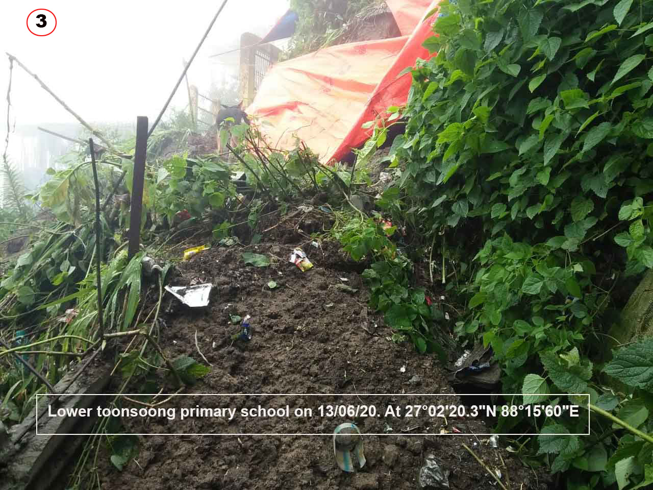
Six of the landslides which took place within the Municipal Limits of Darjeeling are shown in the map:-
Coordinates of these landslides and two others which are known to have taken place at Kurseong and Mungpoo are given below:-

Images of the landslides at Mungpoo and Sivitar T.E, Kurseong are placed below:-

Rainfall data of 2020 for our region is placed below:-
From the rainfall data it is very evident that, except for Gangtok ie East and North Sikkim, the whole region has been deficient in rainfall not only in 2020 but from the end of the monsoon season in 2019. As such I wonder how 6 landslips (small landslides) were triggered by the first burst of heavy rain (109mm) in Darjeeling town?
It is not abnormal to receive 100mm of rain over a 24hr period during the monsoons, what is abnormal is that this rain coming after a prolonged dry period caused so many landslips in Darjeeling town.
Each of those slope failures were capable of taking human life and our experience over the years has been that it is these small landslides in an urban setting which cause most of the fatal landslides. Saying so, I am painfully reminded of a fatal landslide barely 5 mins walk from my home in Jun2010, at Tirpai Kalimpong when it rained only 45mm overnight. It snuffed out the lives of a young mother and her 2 school going children.
In saying so, I must point out that occurring in densely populated urban settings, the trigger for the  landslide always has a human component and in most cases it boils down to managing our drainage system well. The high volumes of surface runoff from the intense rain in our towns must be drained away quickly and safely - otherwise they are bound to do mischief.

Praful Rao,
Kalimpong district
Darjeeling-Sikkim Himalaya


Sunday, July 7, 2019

The aftermath of 150mm of rainfall in 12hrs at Kalimpong (06Jul2019)


It started raining at around 1.00pm in Kalimpong yesterday and what started as a gentle shower intensified late evening (see intensity graph) and night and ended up dumping over 150mm of rain in parched Kalimpong over a 12hr period.
In this region rainfall peaks in July with a monthly average of 615.8 mm. 157mm of rain of (06Jul) therefore accounts for 25% of the monthly rain and is equal to approx 7 days rain all coming down withing a 12hr span.
The aftermath is shown in a photo essay below:


Praful Rao
Kalimpong district
Darjeeling-Sikkim Himalaya

Friday, July 17, 2015

Landslides in Kalimpong - A pictoral report (July2015)


On 30Jun/01July2015 torrential rains lashed Kalimpong dumping 227mm of rain in a 8hr period. This triggered numerous landslides both within the municipal limits and in the sub-division. STH did a survey of some of the affected areas which are indicated on the map above. Images from the areas are placed below.

As per the GSI, the Darjeeling- Sikkim Himalaya is one of the most landslide prone areas in the country and as per Dr David Petley, this area also is one of the global hotspots for fatal landslides.
SaveTheHills (STH) has, in this blog, over the years tried to maintain a historical record of this disaster form which has not received due recognition the world over so as to offer undeniable proof of a scourge which is growing worse in this region as human interference in the mountains increases.
In July2015, after 3 yrs of low landslide activity, we are witnessing a spurt in the number of landslides in Darjeeling district (esp in Kalimpong and Mirik) due to erratic and intense rainfall.
Rainfall records for Kalimpong and this region are placed here ( 1 and 2 ).
What is also clear is almost all the fatalities especially in urban or semi-urban settings are the result of poor or non-existent drainage.
While we have tried to cover many areas of the sub-division in our survey, large areas remain uncharted due to lack of resources and what is shown above is only the tip of the iceberg. (Major landslide areas south of the river Relli have not been included in our survey.)
GPS co-ordinates of all landslide listed are placed below:-


Placemark  Latitude
Longitude
1
 27° 4'40.69"N  88°28'57.54"E
2
 27° 4'57.11"N  88°29'13.31"E
3
 27° 5'6.11"N  88°29'24.97"E
4
 27° 4'23.12"N  88°27'17.35"E
5
 27° 3'28.51"N  88°26'45.02"E
6
 27° 3'59.18"N  88°28'25.21"E
7
 27° 2'50.46"N  88°28'52.10"E
8
 27° 4'23.45"N  88°29'18.64"E
9
 27° 3'4.14"N  88°26'33.45"E
10
 27° 4'8.12"N  88°29'38.10"E
11
 27° 2'42.50"N  88°39'4.80"E
12
 27° 5'13.50"N  88°39'41.10"E
13
 27° 5'59.00"N  88°40'56.60"E
14
 27° 6'16.50"N  88°40'48.40"E
15
 27° 4'10.20"N  88°38'1.70"E
16
 26°57'42.60"N 88°41'56.00"E
17
 27° 3'8.72"N  88°39'19.75"E
18
 27° 9'34.50"N  88°38'12.50"E


Praful Rao,
Kalimpong,
Dist Darjeeling

Tuesday, May 21, 2013

Excerpt from Indian Express : UNESCO may give 'endangered' tag to Darjeeling heritage line


The 132-year-old Darjeeling Himalayan Railway (DHR), the country's only railway line which is a World Heritage Site, may be labelled as an "endangered site" by the Unesco, if nothing is done by India soon.

Recently, the Unesco office in New Delhi had suggested to the Railways to send a senior official to its World Heritage Centre in Paris, France, to apprise its team that is concerned about the progress in restoration work. To be on the World Heritage List implies that the site needs to fulfil a certain criteria as mentioned in the Unesco World Heritage Convention.

Popularly known as the Toy Train, the DHR is a 78-km-long narrow guage line that connects New Jalpaiguri and Darjeeling in West Bengal. Built between 1879 and 1881, the line touches the maximum elevation of 2,200 metres, including Ghum, the highest railway station in India. The DHR received the World Heritage Site in 1999.

However, since 2010, the line has been facing disruptions. It was severely hit by the 2011 earthquake in Sikkim. Several assessments say the restoration work has been slow due to the apathy from both the Centre and the state.

In a letter to Minister of State for Railways, A R Chowdhury, Director and Unesco representative to India, Bhutan, Maldives and Sri Lanka, Shigeru Aoyagi, has said that the state of DHR is serious. "If no action is taken by the government of India to restore it urgently, there may be a chance that the Intergovernmental Committee of World Heritage Convention [may] advise to place the DHR in the list of endangered sites to provide focused attention for conservation," the letter stated.

Chowdury has been assigned to follow-up on this issue since the DHR is in his home state.

The Unesco has also started talks with the Heritage directorate of the Railway Ministry for a technical cooperation to develop a Comprehensive Conservation Management Plan. If everything goes well, the plan may be ready by August.


Comment by Praful Rao
On 31Jul2012, I spent an entire day at the Tindharia workshop area, checking the drainage flow in the vicinity of the Tindharia DHR workshop and interacting with locals and DHR authorities. The captioned photographs above are from that visit.
My personal (gloomy) assessment based on the lack of progress of any landslide prevention measures there till date is that if we have prolonged and heavy rainfall in the area during the ensuing monsoons, parts of the heritage workshop will certainly crumble into the massive landslide which has already damaged the structure.

Sadly, the truth is that having wasted the valuable dry season (0ct2012-Apr2013) when major slope stabilization works should have been undertaken, we have the south westerly monsoons knocking at our doorstep once again (June first week). 
And it is common knowledge here that except for fire-fighting measures no serious river training, drainage correction or slope stabilization work can be undertaken in the next 4-5 months of rains as such we will have to wait until after the monsoons (ie till Oct2013) for any major stabilization work to be initiated.
And that, may just be a little too late.

Praful Rao,
Kalimpong