Showing posts with label awareness. Show all posts

Wednesday, May 20, 2026

Using the Automatic Weather Station data to understand weather and rainfall (in this case, of Kalimpong)

The rainfall chart for the period May2025 to May2026 for Kalimpong is above and a brief analysis of the same here👇:
a. We had a fairly wet monsoon season (from approx May to Oct2025) characterized by 9 spikes when rainfall exceeded 90mm in a 24hr period. The season did start with some hiccups though:
Typical cloud image over North Bengal and Sikkim before the heavy rain of 19Jun2025
Warning on 13Jul2025 for the heavy rain (112.8mm) on 14Jul2025.

July is typically the wettest month of the monsoon season. In July 2025, there were four days during which rainfall exceeded 90 mm in a 24-hour period. Thereafter, rainfall gradually declined, apart from a brief spike on 12 August 2025. Total rainfall amounted to 467 mm in August and 253.2 mm in September 2025.

October 2025 was relatively dry, except for two days of intense rainfall. On 4–5 October, widespread heavy rain affected the entire region and triggered devastating landslides and flash floods, resulting in significant loss of life in Mirik.

These instances of spikes in rainfall are normally associated with convective clouds and normally consist of short, violent bursts of rainfall which cause high runoff and low infiltration of water (as such no recharge of aquifers) and only result in soil erosion, landslides and damage to roads.

 
After the 2025 monsoons, we went thru an extended 5 month period of drought-like conditions from November2025 to March2026.

Praful Rao
SaveTheHills
savethehills@gmail.com
9475033744 

Saturday, March 22, 2025

Updated satellite images of Oct 2023 GLOF affected areas from Google Earth

Google Earth has recently (Jan2025) made available high resolution images of some areas of North Sikkim which reveal the devastating impact of the Glacial Lake Outburst Flood (GLOF) of Oct2023 in North Sikkim. The images below juxtapose the affected areas with historical snapshots, illustrating the catastrophic consequences of the GLOF.

Chungthang town / confluence of the Lachen and Lachung Chu

Chungthang (elevation 1790m/5870', 27.62°N 88.63°E), a town in North Sikkim, is situated at the confluence of the Lachen Chu and Lachung Chu rivers, which merge to form the Teesta river.
On October 3, 2023, an avalanche triggered a GLOF in South Lhonak glacial lake (elevation 5200m/17000'), approximately 75km upstream from Chungthang along the Lachen Chu. The resulting sudden release of around 50 million cubic meters of water made it the largest GLOF in the Himalayas in recent history.
For a detailed account of this event, refer to this publication in Science magazine
STH has closely documented the Teesta valley GLOF of Oct2023 in this blog from the date of occurrence.
Satellite images along with photos of the affected areas are placed below:-

Chungthang town (close up)

Chungthang town (Dec2024)
The still devastated playground and army camp area is seen at the center with the gilded dome of the Gurudwara towards the right side.
Chungthang town playground on 19Nov2023 when we visited the area.

The 1200mw Sikkim - Urja dam and bridge at Chungthang

This was the largest dam in Sikkim and was located downstream of the confluence of the Lachen and Lachung Chu rivers. The 60m rockfill, run of the river dam was commissioned in Feb 20217 at a cost of Rs 14,000crores. Along with the dam, a major bridge (centre top of photo) connecting Chungthang to the rest of Sikkim was also destroyed by the GLOF.
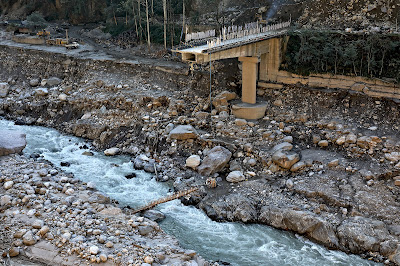
The remnants of Sikkim Urja dam which collapsed in the GLOF on 04Oct2023. Photographed on 18Nov2023, when we visited Chungthang.
A double laned concrete bridge connecting Chungthang to the rest of Sikkim was destroyed by the GLOF here on 04Oct2023

Munshithang (27.6324° N 88.6157° E)

Munshithang, an ammo depot for the Indian army was totally destroyed by the 04Oct Teesta Valley GLOF. On receiving warning of the rising waters in the Lachen Chu, 92 personnel of the ammo depot moved to  higher ground and thus their lives were saved. However, it was 4 days before they could be evacuated - due to bad weather which prevented helicopter flights.
Nothing could be retrieved of the ammunition and equipment lost to the GLOF.

Toong bridge over the Teesta river  (27°33'0.15"N 88°38'35.17"E)

We visited this area on 19Nov2023 and photographed the bridge and the Toong checkpost both of which were destroyed by the GLOF (below)

There was only a small bamboo bridge across the Teesta for pedestrians to cross the river on foot in Nov2023
The Toong police checkpost had been vacated and dangled precariously from the edge of the road
Another view of the vacated police checkpost in Nov2023
Faced with the sheer necessity of communicating, the local community start constructing a wooden bridge across the Teesta at Toong.

 Naga Gram Panchayat (Mangan district, North Sikkim)

Naga GP is located approx 14km from Mangan (district HQ of N Sikkim district) towards Toong and was one of the worst affected areas when we visited Chungthang on 19Nov2023.

It continues to be a wrecked and desolate place as can be seen from the recent photos (of Dec2024) below (photo credits: Rinchen Lama, IIHS ,Bangalore)
Google Earth has unfortunately not updated satellite images of areas south of Naga area (North Sikkim) which are still of 2022 vintage as such they do not show the impact of the GLOF in these areas.


Praful Rao
SaveTheHills
savethehills@gmail.com
9475033744

Tuesday, August 29, 2023

Extraordinary high intensity and very localized rainfall of 29Aug2023 at Kalimpong

Meteorological conditions
28Aug2023 was a cloudy day and except for a little early morning rain, it was dry in Kalimpong. We even had a rare 'NO WARNING' for Sub-Himalayan West Bengal (SHWB) and Sikkim.

Cloud images showed fairly settled weather in our region through the day - even until 8.15pm on 28Aug2023, when I put a last post in 'Hazard Alerts' our What's App 'Early Warning' group in the Darj-Sikkim region.
                  Above image shows no major clouding in the area circled.

The clouding suddenly increased thereafter, as seen in the IR Image of 11.45pm of 28Aug2023:
              Notice the clouding which has suddenly appeared below Kalimpong

Nowcast issued by IMD is placed below

Rainfall of 29Aug2023 morning
We had sudden and very intense rainfall starting from 1.30am with peak intensities crossing 135mm/hr. The rainfall amount was 79.2mm in a very short time.
The screenshot of Damini (Lightning Alert app) showing no lightning at 3.06am in our area is below
And at 3.45am, with the rainfall declining over Kalimpong, the clouding vanished, just as quickly as it had appeared.
What is amazing in this event, besides the extremely sharp increase and decrease of rain intensity, is that it rained only over Kalimpong.
Adjoining towns of Darjeeling, Kurseong and Todey (where there are Davis automatic weather stations) had ZERO rainfall


QUESTION IS:
ARE WE PREPARED FOR THIS TYPE OF RAINFALL WHICH IS NO LONGER EXTRAORDINARY BUT BECOMING THE NEW NORMAL?

Praful Rao
Kalimpong district
Darjeeling-Kalimpong Himalaya
savethehills@gmail.com
9475033744


Sunday, June 18, 2023

The sudden and heavy downpour of 17Jun2023 in Kalimpong.

Kalimpong experienced its first really heavy, showers in a thunderstorm which lasted for almost 90min from 7.00pm on 17Jun2023.
I checked the IR imagery and lightning at 5.30pm on 17Jun with a group of IIT (Mandi) interns and mentioned to them we had no lightning nor convective clouds in our vicinity. There was absolutely no indication that a severe thunderstorm was building up and the NOWCAST warnings for heavy rain also do not indicate this.


The timeline of satellite images below indicate how CB clouds developed and moved eastwards over Kalimpong from the hills of Nepal.
The rainfall intensity graph from the DAVIS AWS at my home shows that we had heavy rain (ie above 40mm/hr) for an hour at least and that we received almost 60mm of rain during this period.

Videos sent to our WhatsApp group by members show the severity of the downpour in Kalimpong on 17Jun2023 evening.         


Update on 19Jun2023


My thanks to HA Members who shared the videos.

We had 101mm of rain in the last 24hrs (all of it from approx 7pm last evening till 4am on 18Jun2023)

Praful Rao
Kalimpong district
Darjeeling-Sikkim Himalaya
savethehills@gmail.com
9475033744


Friday, May 5, 2023

AI generated images of landslide disasters

I have always been fond of both computers and photography, so I am amazed by the awesome capablities of ChatGPT. I also shudder at what AI can do in art, photography and maybe even music.
To learn a little more about AI in photography, I have been tinkering around with playgroundai.com since yesterday. This is a free AI software on the internet.
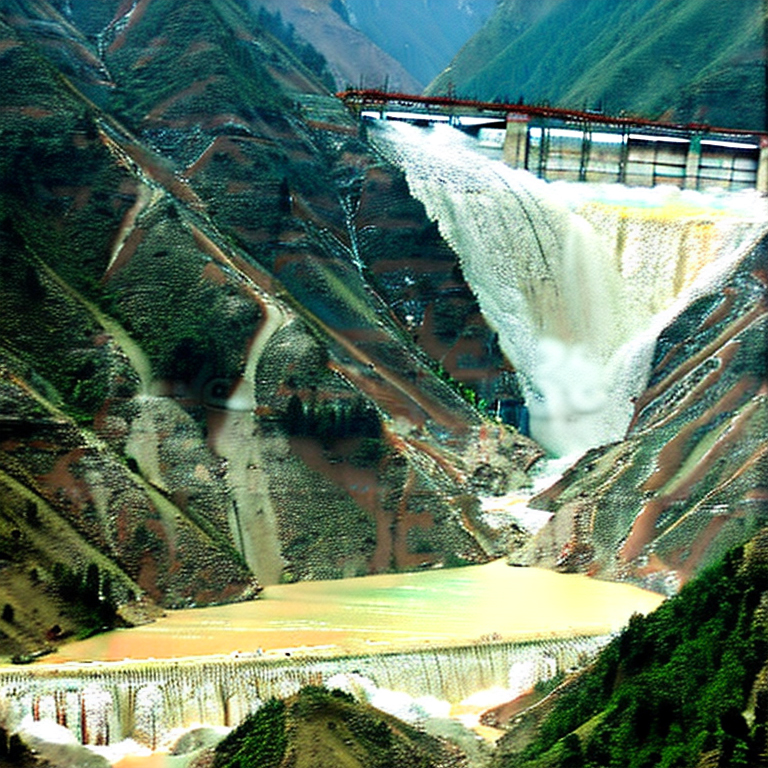
Placed below are several images I created since then and am shocked how realistic they become as one gains more experience in using the software. I used keywords related to the Himalayas and landslides to generate the first 3 images and then on earthquakes and dams to create the latter two.
Keywords related to Landslides and Himalayas


Keywords related to Earthquakes and dams in the Himalayas


All the above images are as created by AI without my editing them in Photoshop (PS). The quality of the images can certainly be improved:
a. With more practice
b. By editing them in PS
b. Using midjourney.com - but this is not a freeware.

The image below shows how uncannily close to reality the AI image:


Praful Rao
Kalimpong district
Darjeeling-Sikkim Himalaya